Meghalaya history
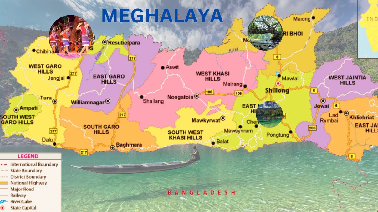
Meghalaya, meaning “the abode of clouds” in Sanskrit, is a state in northeast India formed on 21 January 1972 by carving out the United Khasi Hills, Jaintia Hills, and Garo Hills from Assam. Covering 22,429 square kilometers with a 3:1 length-to-breadth ratio, its 2014 population estimate stood at 3,211,474. The state borders Bangladesh to the south and west and Assam to the north and east, with Shillong as its capital, famously nicknamed the “Scotland of the East” during British rule. The official language is English, and the state follows a matrilineal system, where inheritance is traced through women, with the youngest daughter inheriting wealth and caring for her parents.
Known as India’s wettest region, Meghalaya’s southern Khasi Hills receive an annual average rainfall of 12,000 mm (470 in). Approximately 70% of the state is forested, with its subtropical forests boasting rich biodiversity in mammals, birds, and plants. The economy is predominantly agrarian, with key crops like potatoes, rice, maize, pineapples, bananas, and spices. Meghalaya also has a commercial forestry industry but lacks significant industrial development despite being rich in minerals. Its 2012 gross state domestic product was estimated at ₹16,173 crore (US$1.9 billion). The state serves as a logistical hub for trade with Bangladesh, connected via 1,170 km of national highways.
Meghalaya: The Abode of Clouds – A Unique Gem of Northeast
In July 2018, the International Commission on Stratigraphy recognized the Meghalayan stage of the Holocene epoch, named after a speleothem in Mawmluh cave, which recorded a dramatic global climate event around 2250 BCE. Shillong is also home to the North Eastern Council Secretariat, one of the largest central institutes in the region. The name Meghalaya derives from the Sanskrit words “megha” (cloud) and “alaya” (abode).
The Historical Journey of Meghalaya
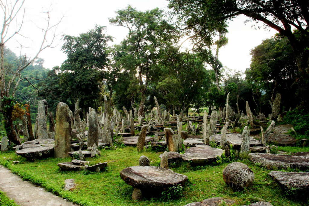
Meghalaya, often referred to as the “abode of clouds,” holds a rich and diverse history that dates back to the Neolithic period, as evidenced by archaeological discoveries in the Khasi Hills, Jaintia Hills, and Garo Hills. These highland plateaus, with their fertile soil and abundant rainfall, were ideal for human settlement, particularly for practices like jhum cultivation, which continues to this day.
Early Archaeological Significance
Neolithic tools and artifacts found in the region suggest ancient human activity. Scholars have also theorized that Meghalaya may have played a role in the domestication of rice, a staple crop, with over 20,000 species identified in India. The state’s archaeological site at Bhaitbari, located near the Meghalaya-Assam border, revealed a fortified city dating back to the 4th-8th century CE, speculated to be linked to the ancient kingdom of Kamarupa.
Medieval Influences and Islam’s Introduction
Following the Conquest of Taraf in 1304, Shah Arifin Rafiuddin, a disciple of the renowned Shah Jalal, migrated to the Khasi and Jaintia Hills, spreading Islamic monotheism. His khanqah (spiritual retreat) in the Laurergarh area is a testament to this era, with part of the site now lying in Meghalaya.
British Era and Political Reorganization
The British influence began in 1835, incorporating the independent Khasi, Jaintia, and Garo kingdoms into Assam. Although semi-autonomous under treaties with the British Crown, these areas faced significant changes during colonial rule.
- In 1905, the controversial partition of Bengal temporarily placed Meghalaya under the province of Eastern Bengal and Assam.
- The Government of India Act 1919 and 1935 classified parts of Meghalaya as “backward tracts,” segregating them as either excluded or partially excluded regions under British administrative policies.
Post-Independence Movement for Statehood
After India gained independence in 1947, Meghalaya remained a part of Assam but with limited autonomy. This led to the hill state movement in the 1960s, demanding greater autonomy for the tribal regions. Key developments include:
- 1969: The Assam Reorganisation (Meghalaya) Act established Meghalaya as an autonomous state within Assam.
- 1971: The North-Eastern Areas (Reorganisation) Act granted Meghalaya full.
Exploring the Geography and Natural Diversity of Meghalaya
Meghalaya, a stunningly picturesque state in northeast India, earns its name as the “Abode of Clouds.” Its unique landscape, rich biodiversity, and geographical significance make it a vital part of India’s Seven Sister States.
Topography and Geological Significance
Meghalaya is a mountainous state with an intricate mix of valleys, highland plateaus, and rich geological formations primarily composed of Archean rocks. These formations are home to valuable mineral deposits, including coal, limestone, uranium, and sillimanite.
The Khasi Hills, Jaintia Hills, and Garo Hills form the three main regions of the plateau, with elevations ranging from 150 meters to 1,961 meters. The Shillong Peak (1,961 m) in the Khasi Hills is the highest point, offering breathtaking views of the capital city, Shillong. In the Garo Hills, Nokrek Peak stands as the tallest, with an altitude of 1,515 meters.
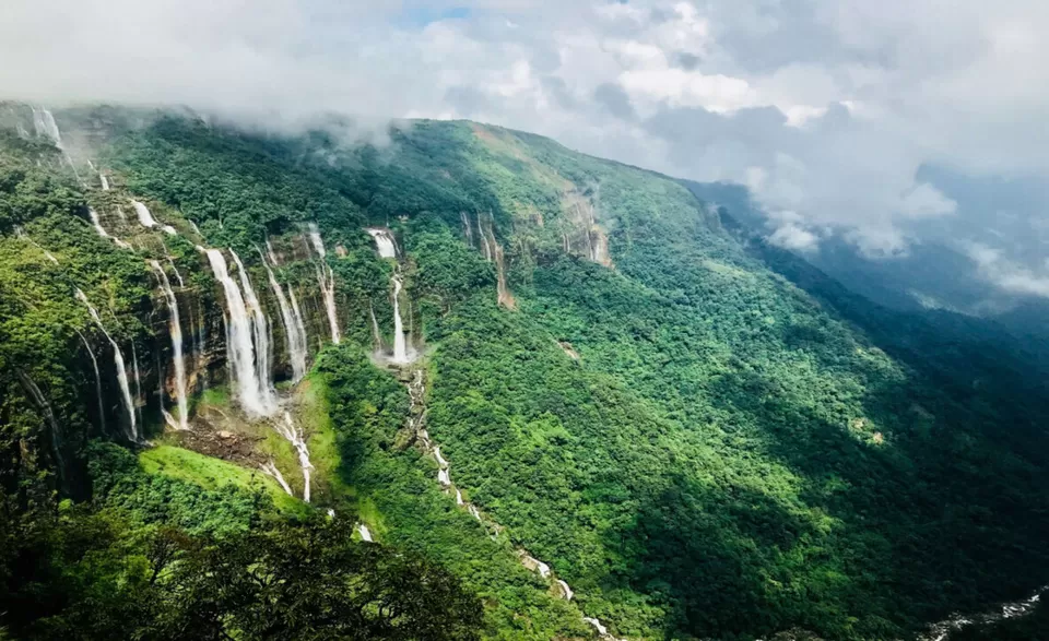
The state is drained by numerous rainfed rivers. Key rivers include the Simsang, Umngot, and Umiam, which carve deep gorges and create stunning waterfalls in the southern Khasi Hills.
Climate: The Wettest Place on Earth
Meghalaya holds the record for being the wettest place on Earth, with annual rainfall reaching up to 12,000 mm in certain areas.
- Cherrapunji (Sohra) boasts the world record for the most rainfall in a single calendar month.
- Nearby Mawsynram holds the record for the highest annual rainfall, making these regions globally recognized for their unique climatic conditions.
The climate varies across the state, with the Garo Hills experiencing warmer temperatures and the higher altitudes of Shillong offering cooler, temperate conditions. Summers rarely exceed 28°C, while winters often witness sub-zero temperatures.
Biodiversity: Flora and Fauna
Forest Cover and Sacred Groves
Approximately 70% of Meghalaya is covered by forests, with dense subtropical forests spanning 9,496 square kilometers. These forests are among the richest botanical habitats in Asia, nurturing diverse flora and fauna.
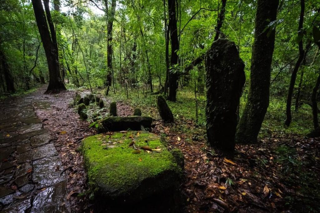
A unique cultural feature is the preservation of sacred groves, small patches of ancient forests maintained for religious rituals and cultural traditions. These groves harbor rare and endemic species of plants and animals, reflecting the deep-rooted ecological values of local communities.
Key biodiversity hotspots include:
- Nokrek Biosphere Reserve (West Garo Hills)
- Balphakram National Park (South Garo Hills)
- Nongkhyllem Wildlife Sanctuary
- Siju Wildlife Sanctuary
- Baghmara Sanctuary, known for its insect-eating pitcher plant (Nepenthes khasiana).



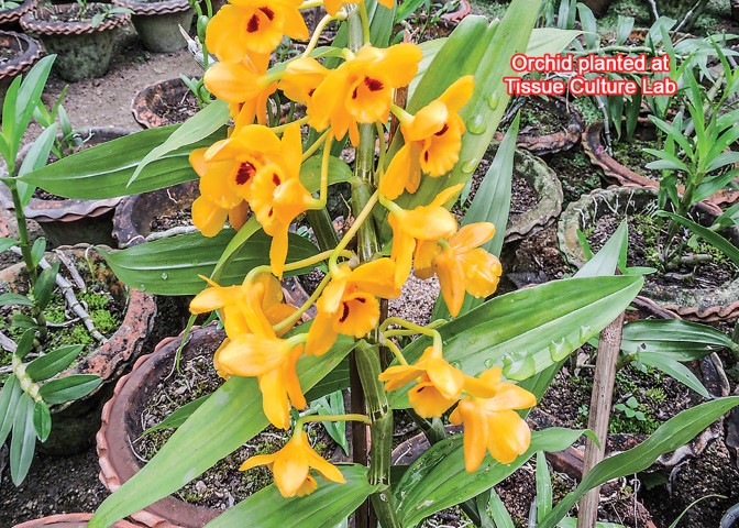
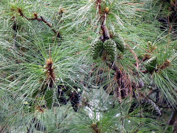
Floral Diversity
Meghalaya is renowned for its:
- 325 species of orchids, predominantly found in the Khasi Hills (Mawsmai, Mawmluh, and Sohrarim forests).
- Trees like sal (Shorea robusta) and teak (Tectona grandis).
- Medicinal plants, fruits, vegetables, and spices integral to the state’s traditional practices.
Faunal Diversity
The forests are home to an impressive variety of mammals, birds, reptiles, and insects.
Mammals:
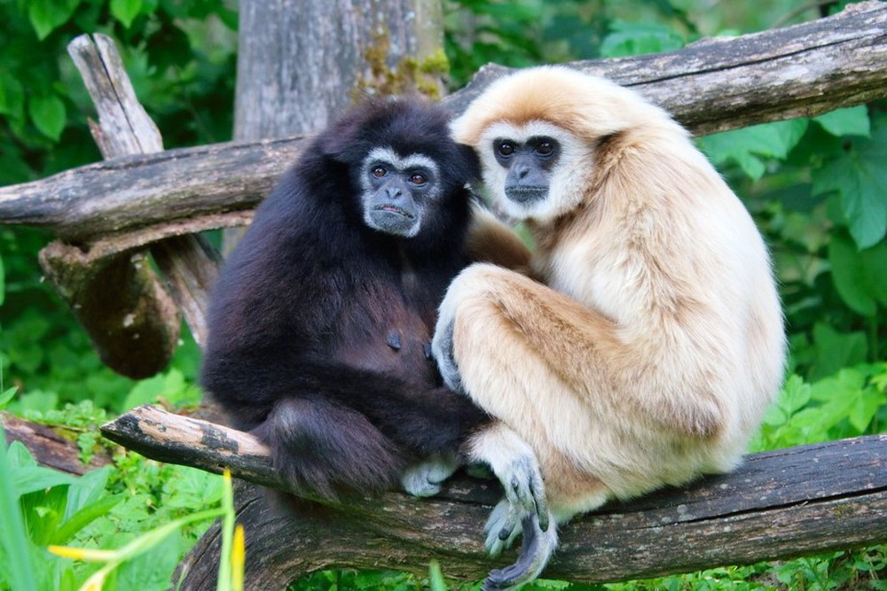
- Notable species include elephants, red pandas, wild boar, gaur, wild buffalo, and primates like the hoolock gibbon.
- Rare species, such as bats found in limestone caves like Siju Cave, further enrich the region’s biodiversity.
Birds:
- Over 660 bird species inhabit the state, with 34 globally threatened and 9 critically endangered species. The great Indian hornbill, grey peacock pheasant, and common green pigeon are prominent avian residents.
- Meghalaya also hosts over 250 butterfly species, showcasing its ecological diversity.
Reptiles and Amphibians:
- The region supports various reptiles, including king cobras, pythons, and copperheads, along with lizards and tortoises.
In 2020, Meghalaya gained attention for the discovery of the largest subterranean fish species in the Jaintia Hills, further underscoring its ecological significance.
Air Quality and Sustainability
Efforts to maintain ecological balance and air quality have borne fruit, with Byrnihat ranked as the 38th cleanest air city in India under cities with a population below 3 lakhs. This achievement reflects the state’s commitment to sustainability.
Demographics of Meghalaya
Population Overview
Meghalaya is a diverse and predominantly tribal state. According to the 2011 Census, the state’s population stood at 2,964,007, with a nearly equal distribution between males (1,471,339) and females (1,492,668). The sex ratio of 986 females per 1,000 males is higher than the national average. Urban areas also display a high female sex ratio of 985, compared to rural areas at 972. Over the decades, Meghalaya’s population growth has been notable, with a 27.82% decennial increase from 2001 to 2011, the highest among the Seven Sister States of Northeast India.
The Khasis are the largest tribal group in the state, followed by the Garos and Jaintias. These communities are collectively referred to as the “hill tribes.” Other ethnic groups include the Bengalis, Hajongs, Biates, Koches, and Nepalis, among others.
Religious Composition
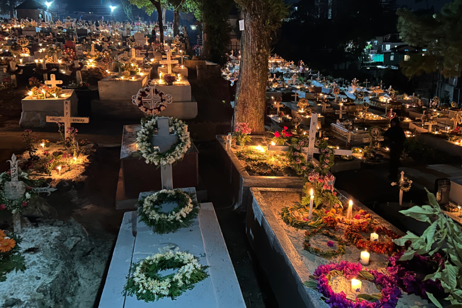
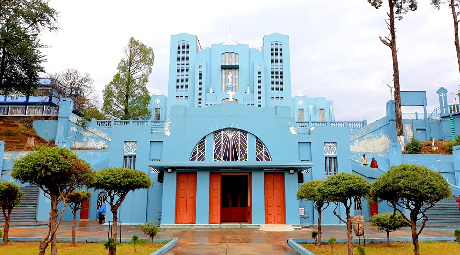
Meghalaya stands out as one of India’s few states with a Christian majority. Approximately 74.59% of the population adheres to Christianity, with Catholics, Presbyterians, and Baptists being the most prominent denominations. The religious composition is closely tied to the state’s tribal heritage.
- Christianity: Predominantly practiced by the Khasi (80%) and Garo (90%) tribes.
- Hinduism: The second-largest religion, practiced by 11.52% of the population, mainly in West Garo Hills, East Khasi Hills, and Ri-Bhoi districts. Notable sites include the Nartiang Durga Temple, one of the 51 Shakti Peethas.
- Indigenous Faiths: Comprising 8.7%, these include Niamtre, Niam Khasi, and Niam Tynrai, rooted in tribal traditions.
- Islam: Constitutes 4.39% of the population, concentrated mainly in West Garo Hills.
- Smaller communities practice Buddhism, Jainism, and Sikhism.
The introduction of Christianity began during the British colonial era in the 19th century, with missions from American Baptists and Welsh Presbyterians playing significant roles. Catholicism gained prominence during the World Wars when other missionaries returned to Europe and America.
Linguistic Diversity
Meghalaya is linguistically vibrant, with English serving as the official language and a unifying medium across its ethnic groups. The most widely spoken native languages are:
- Khasi (33.82%): A Mon-Khmer language enriched with Indo-Aryan influences.
- Garo (31.60%): A Tibeto-Burman language spoken in multiple dialects, such as Abeng, Akawe, and Matchi Dual.
- Pnar (10.69%): Spoken in the Jaintia Hills, closely related to Khasi.
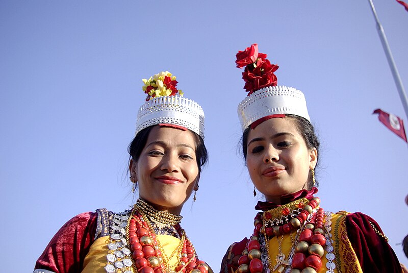

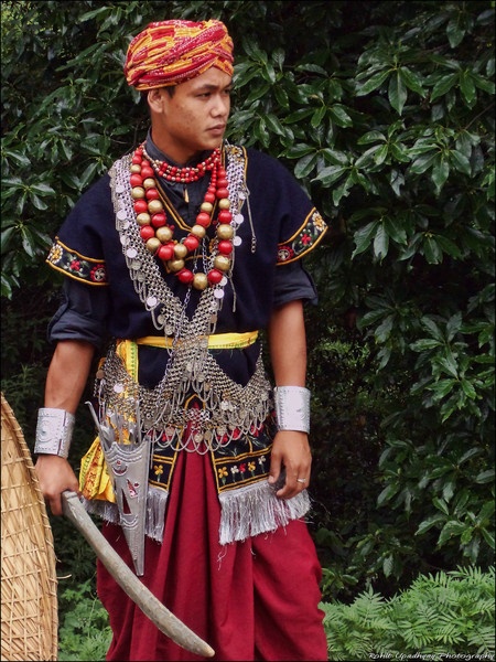


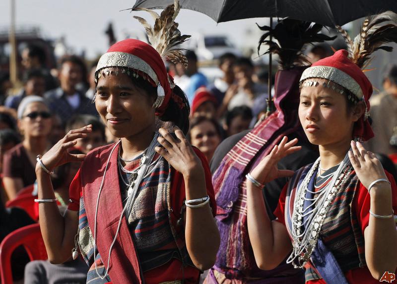
Other significant languages include Bengali (6.44%), Nepali (1.85%), Hindi (1.62%), and Assamese (1.34%), with various local dialects like War, Hajong, and Biate.
Khasi and Garo are unique for their rich linguistic heritage. While Khasi is one of the few surviving Mon-Khmer languages in India, Garo shares ties with the Bodo group of languages.
Districts of Meghalaya
Meghalaya is divided into 12 districts, each with unique characteristics and contributions to the state’s economy, culture, and geography. These districts are organized into three divisions: Jaintia Hills Division, Khasi Hills Division, and Garo Hills Division.
Jaintia Hills Division
- West Jaintia Hills (Jowai)
- Formed in 1972 by dividing the Jaintia Hills district.
- Known for coal and limestone production, vital for Meghalaya’s mining and cement industries.
- Headquarters: Jowai.
- East Jaintia Hills (Khliehriat)
- Created by dividing the Jaintia Hills district further to manage the area’s growing population and industries better.
- Headquarters: Khliehriat.
Khasi Hills Division
- East Khasi Hills (Shillong)
- Formed in 1976 by carving out the Khasi Hills.
- Covers an area of 2,748 square kilometers.
- Headquarters: Shillong, the state capital.
- Known for its urbanization, tourism, and cultural significance.
- West Khasi Hills (Nongstoin)
- The largest district in Meghalaya, with a geographical area of 5,247 square kilometers.
- Formed in 1976 from the Khasi Hills.
- Headquarters: Nongstoin.
- South West Khasi Hills (Mawkyrwat)
- A smaller district with significant rural landscapes.
- Headquarters: Mawkyrwat.
- Ri-Bhoi (Nongpoh)
- Formed in 1992 from East Khasi Hills.
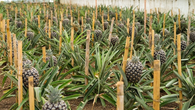
- Known for its pineapple cultivation, forests, and hilly terrain.
- Headquarters: Nongpoh.
- Eastern West Khasi Hills (Mairang)
- The newest district, established in 2021.
- Headquarters: Mairang.
Garo Hills Division
- North Garo Hills (Resubelpara)
- Known for its scenic beauty and rural landscapes.
- Headquarters: Resubelpara.
- East Garo Hills (Williamnagar)
- Formed in 1976, covering 2,603 square kilometers.
- Headquarters: Williamnagar (formerly Simsangiri).
- Rich in coal reserves, with notable mining activities in Nongalbibra.
- South Garo Hills (Baghmara)
- Created in 1992 after separating from West Garo Hills.
- Covers 1,850 square kilometers.
- Headquarters: Baghmara.
- West Garo Hills (Tura)
- One of the oldest districts, covering 3,714 square kilometers.
- Headquarters: Tura, an important urban center.
- South West Garo Hills (Ampati)
- Known for its rural charm and agricultural contributions.
- Headquarters: Ampati.
Human Development Index (HDI)
As of 2021, Meghalaya’s average HDI stands at 0.550, with significant variations across districts:
- East Khasi Hills: 0.676 (highest), reflecting its urban infrastructure and socio-economic development.
- West Garo Hills: 0.571.
- Ri-Bhoi: 0.496, showcasing moderate development levels.
- South Garo Hills: 0.484.
- Jaintia Hills: 0.469, driven by its mining activities.
- West Khasi Hills: 0.405.
- East Garo Hills: 0.396 (lowest), highlighting areas for development.
Education in Meghalaya
Meghalaya offers a diverse and structured education system, focusing on both academic excellence and vocational training. The state follows the 10+2+3 educational model, with schools and colleges offering various streams, including arts, science, and commerce.
School Education
- Medium of Instruction: English is the medium of instruction in schools across Meghalaya. In addition to English, students are taught optional subjects like Assamese, Bengali, Garo, Hindi, Khasi, Mizo, Nepali, and Urdu.
- Affiliation: Schools in Meghalaya are affiliated with several educational boards, such as the Council for the Indian School Certificate Examinations (CISCE), the Central Board for Secondary Education (CBSE), the National Institute of Open Schooling (NIOS), and the Meghalaya Board of School Education (MBoSE).
- Junior Colleges: After secondary school (10th grade), students typically enroll in junior colleges (also known as pre-university or higher secondary schools) for a two-year program. Students can choose between streams such as liberal arts, commerce, or science.
Colleges and Higher Education
Meghalaya offers a variety of colleges and institutes for higher education across multiple disciplines. Some prominent institutions include:
- North-Eastern Hill University (NEHU), Shillong – A leading university in the region offering a wide range of undergraduate and postgraduate programs.
- Indian Institute of Management (IIM Shillong) – A prestigious business school known for its management programs.
- National Institute of Technology (NIT Meghalaya) – Offers technical and engineering education.
- Lady Keane College, Shillong – Known for liberal arts programs, particularly in the humanities and social sciences.
- Shillong College, Shillong – A reputed institution offering both undergraduate and postgraduate courses.
- St. Edmund’s College, Shillong – One of the oldest colleges in the state, offering a variety of courses.
- University of Technology and Management, Meghalaya – A private university offering programs in technology, management, and applied sciences.
- William Carey University, Shillong – Known for its courses in arts, science, and health sciences.
- Martin Luther Christian University, Shillong – A private Christian university with a focus on holistic education.
- National Institute of Fashion Technology, Shillong – Specializes in fashion design and technology education.
Other notable colleges include Don Bosco College (Tura), Kiang Nangbah Government College (Jowai), Synod College (Shillong), and Tura Government College (Tura). These institutions offer a wide range of undergraduate, postgraduate, and professional courses across various fields.
Universities in Meghalaya
- North Eastern Hill University (NEHU) – A central university in Shillong providing a wide variety of courses and research programs.
- Techno Global University, Meghalaya – A private institution known for its technical courses.
- University of Science and Technology, Meghalaya (USTM) – Offers a wide range of engineering and science-based courses.
- CMJ University, Jorabat – A private university offering a variety of undergraduate and postgraduate courses.
Government and Politics in Meghalaya
Meghalaya operates under a parliamentary system, with a Governor as the head of the state and an elected Chief Minister heading the government. The state has its own set of political and legal institutions.
State Government
- Meghalaya Legislative Assembly: Comprises 60 members, representing the state’s various constituencies.
- Lok Sabha: Meghalaya is represented by two Members of Parliament, one each from Shillong and Tura.
- Rajya Sabha: The state has one representative in the Rajya Sabha.
- High Court: The Gauhati High Court had jurisdiction over Meghalaya until 2013, when Meghalaya got its own High Court, which operates from Shillong.
Local Self-Government
- Meghalaya follows the Sixth Schedule of the Indian Constitution, which provides for the formation of Autonomous District Councils (ADCs) for the management of local affairs in tribal areas. These councils have legislative, executive, and judicial powers over specific areas.
- Garo Hills Autonomous District Council (GHADC)
- Khasi Hills Autonomous District Council (KHADC)
- Jaintia Hills Autonomous District Council (JHADC)
These ADCs play a significant role in governance, particularly in rural and tribal areas, where traditional systems of governance coexist with modern administrative structures.
Economy of Meghalaya
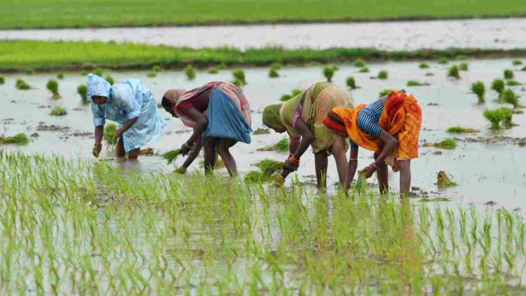
Meghalaya is primarily an agrarian economy, with agriculture and allied activities engaging nearly two-thirds of the state’s total workforce. Despite the large proportion of the population relying on agriculture, the state imports much of its food from other regions due to low agricultural productivity and unsustainable farming practices. The state’s Gross State Domestic Product (GSDP) in 2012 was estimated at ₹16,173 crore (US$1.9 billion), and around 12% of the population lives below the poverty line, particularly in rural areas where the rate is higher.
Agriculture
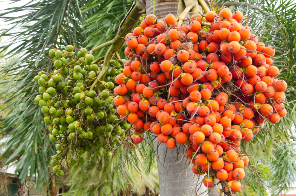
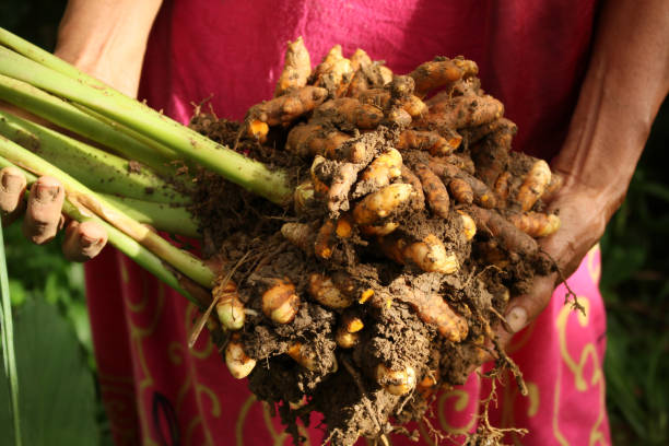
Agriculture in Meghalaya supports about 80% of the population, with nearly 10% of the state’s geographical area used for cultivation. The state’s agricultural practices are characterized by low productivity and limited use of modern techniques. Rice is the dominant crop, accounting for over 80% of food grain production, followed by other cereals like maize, wheat, and pulses. In addition to these staple crops, the state produces cash crops such as ginger, turmeric, areca nut, black pepper, cotton, and jute.
The state also has a growing horticulture sector, producing fruits like oranges, pineapples, bananas, and guavas, as well as vegetables such as cauliflower, cabbage, and radishes. However, the adoption of high-yielding varieties (HYVs) in crops like rice and maize has improved productivity over the years, particularly since the introduction of cold-tolerant rice varieties like Megha I and Megha II.
Industry
Meghalaya is rich in natural resources, including coal, limestone, granite, and sillimanite, although the state’s industrialization has been slow due to infrastructural limitations. The state has witnessed the establishment of cement manufacturing plants, particularly in the Jaintia Hills district, which utilize the region’s high-quality limestone deposits.
Electricity Infrastructure
Meghalaya has significant potential for hydroelectric power generation, with an estimated capacity of over 3000 MW. However, the state currently has an installed capacity of 185 MW, insufficient to meet the growing demand. Meghalaya imports electricity to meet its needs and aims to enhance its power generation capacity, with projects like the Garo Hills thermal project and several hydroelectric plants under development to ensure self-sufficiency and future exports.
Urbanization and Infrastructure
The state has several urban areas, including Shillong, Tura, and Jowai, which have municipalities and town committees. The Shillong Urban Agglomeration includes the town of Shillong and surrounding areas like Mawlai, Madanrting, and Nongthymmai, with proposals for expanding municipal corporations to accommodate growing urbanization. The state has also seen improvements in health and educational infrastructure, including the establishment of institutions like the Indian Institute of Management (IIM) Shillong and the University of Technology and Management (USTM).
Despite progress in sectors like education, health, and industry, Meghalaya still faces challenges in economic growth, particularly due to low industrial development, inadequate infrastructure, and the poverty rate in rural areas. These factors limit the state’s potential to create high-income jobs at the same pace as the rest of India.



Culture and Society of Meghalaya
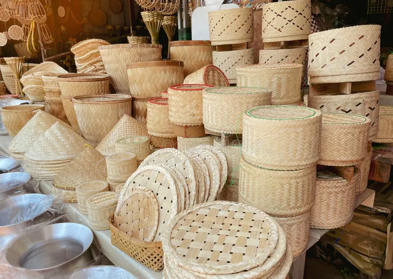
Meghalaya is home to a rich tapestry of cultures, with the primary tribes being the Khasis, Garos, and Jaintias. Each tribe has its distinct traditions, dress, language, and customs that contribute to the state’s cultural diversity.
Social Structure and Traditions
A unique aspect of Meghalaya’s tribal society is its matrilineal system, where lineage and inheritance are traced through women. This practice is prevalent among the Khasi, Jaintia, and Garo tribes. In this system, the youngest daughter, known as the Khun Khatduh among the Khasi and Jaintias, inherits the family property and assumes the responsibility of caring for elderly parents and unmarried siblings. If a family lacks a daughter, they may adopt a girl, often from another family, to inherit the property and take on these responsibilities. This form of inheritance ensures that the family lineage and estate are preserved within the female line.
In the Garo tribe, the youngest daughter is also the primary heir, and in the absence of a daughter, a daughter-in-law or an adopted child may take over this role. These customs reflect the deeply ingrained respect for women within these cultures, a key feature of Meghalaya’s matrilineal society.
Civil Society and Social Organizations
Meghalaya’s civil society is highly organized, with numerous civil society organizations (CSOs) working to serve the public good. These range from non-governmental organizations (NGOs) focusing on charity, social empowerment, and volunteer services to community associations that foster local unity and support specific ethnic groups. There are over 181 NGOs operating in the state, many of which are ethnically focused, such as the Khasi Students’ Union (KSU), Jantia Students’ Union (JSU), and Garo Students’ Union (GSU). These organizations often advocate for the rights and interests of their communities and play a significant role in local governance and social issues.


Philanthropic foundations, like the Public Health Foundation of India (PHFI), work alongside the government to improve public health, especially in rural areas. However, the effectiveness of these civil society organizations is debated, with some arguing that they face limitations due to both central government policies and local insurgencies.
Traditional Political Institutions
Meghalaya’s traditional political institutions are organized into a hierarchical system based on the tribe. The Khasis and Jaintias have a structured system of councils and assemblies at various levels, from the village to the state. The village councils, known as Dorbar Shnong, are presided over by a headman, while the larger political units called raids are managed by the Syiem (king). The Syiemship oversees several raids, with an elected state assembly known as the Durbar Hima.
The Garos, on the other hand, have a political structure based on A·king, a group of villages overseen by a Nokma. The Nokma holds judicial and legislative authority over the Garo people and is the central figure in Garo governance. These traditional systems reflect the tribal peoples’ deep connection to their land and the values of collective decision-making.
Festivals and Cultural Celebrations
Festivals are an essential part of life in Meghalaya and play a significant role in maintaining the region’s cultural heritage. The most widely celebrated festival in the state is Christmas, particularly in areas like Shillong and Cherrapunji, where the Christian majority celebrates the occasion with great zeal. The entire state is adorned with Christmas trees, lights, and carols, creating a festive atmosphere across the region.
Other important festivals include:
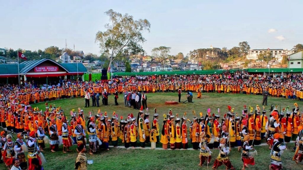
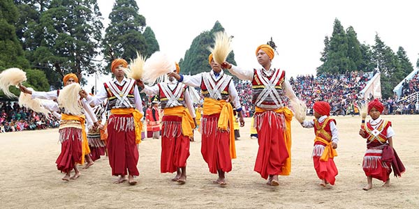
- Ka Shad Suk Mynsiem (Khasi dance festival)
- Behdienkhlam (Jaintia festival)
- Wangala (Garo harvest festival)
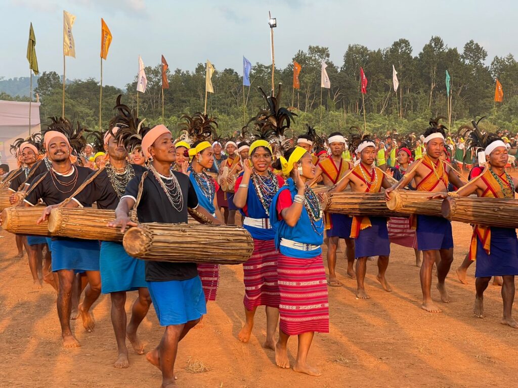
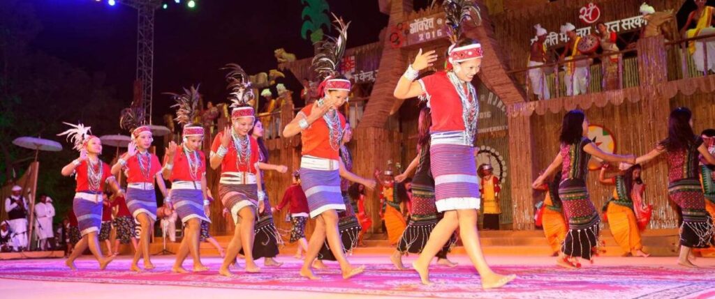
These festivals not only celebrate religious and seasonal events but also serve as occasions for people to come together, perform traditional dances, and strengthen community bonds.
Dance and Performing Arts
Dance is an integral part of the cultural life of the Khasis, Jaintias, and Garos. For the Khasis, dances like Ka Shad Suk Mynsiem and Ka Pom-Blang Nongkrem are central to their rites of passage. Similarly, the Jaintias celebrate dances like Laho and Sowing Ritual Ceremony, while the Garos perform dances such as Rongchu gala and Den Bilsia to mark important events in their agricultural and religious calendars.
Spirituality and Religious Influence
While the majority of Meghalaya’s population follows Christianity, elements of traditional beliefs and Hinduism also hold significance. For example, the Mawjymbuin Cave in southern Meghalaya houses a naturally formed stalagmite shaped like a Shivalinga, which is venerated by the local Jaintia people during the Hindu festival of Shivratri. This blend of traditional beliefs with mainstream religions illustrates the syncretic nature of spirituality in the state.
Living Root Bridges
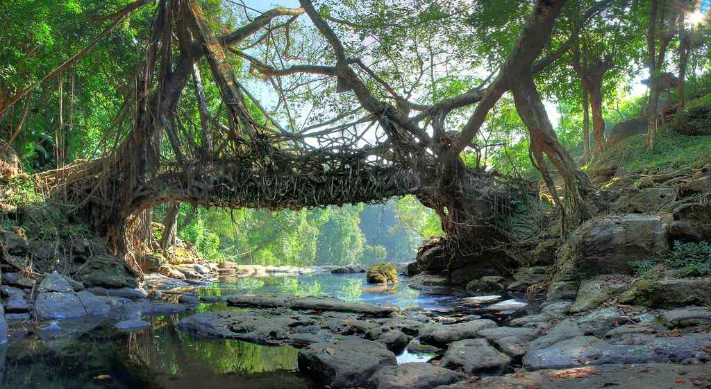
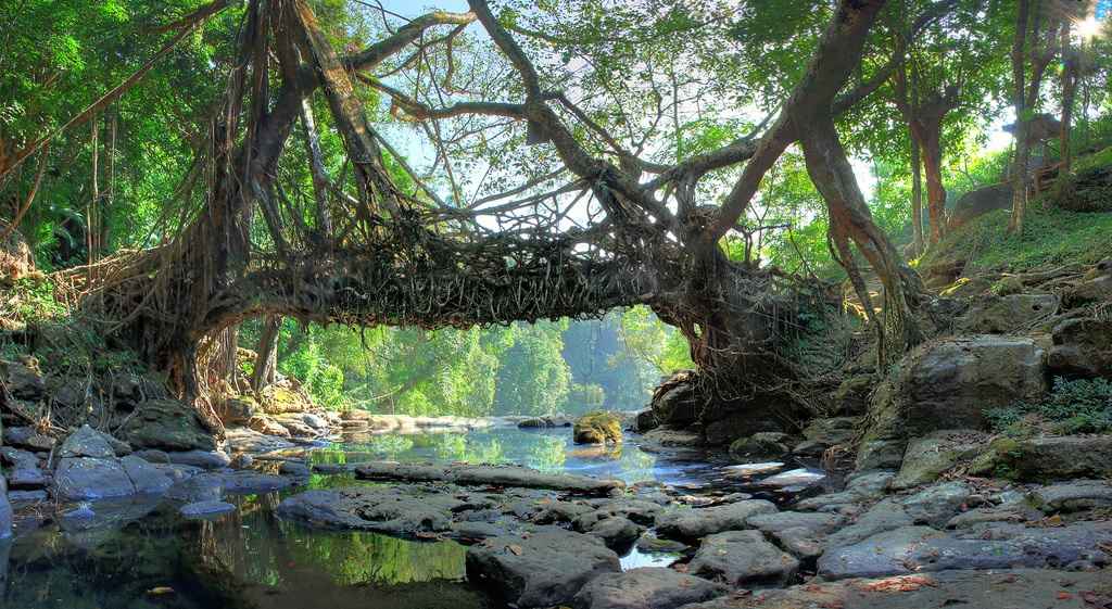
One of Meghalaya’s most remarkable cultural and architectural practices is the creation of living root bridges. These functional bridges are made by training the aerial roots of rubber trees, creating a unique form of natural architecture. The most famous of these is the Double-Decker Living Root Bridge in Nongriat Village, which is a popular tourist attraction. These living structures are both environmentally sustainable and culturally significant, although their number is dwindling due to natural disasters and the replacement of traditional bridges with modern infrastructure.
In conclusion, the cultural and societal fabric of Meghalaya is a vibrant blend of traditional practices, festivals, and unique social structures. From its matrilineal heritage and traditional political systems to its colorful festivals and living root bridges, Meghalaya stands as a testament to the resilience and adaptability of its people, preserving a rich legacy in the face of modern challenges.
Transport
Meghalaya, located in Northeast India, faces significant infrastructural challenges due to its geography and historical development. The state’s road network, especially in rural areas, remains underdeveloped compared to national averages, hindering accessibility and connectivity. The road density in the state stands at 41.69 km per 100 square kilometers as of 2011, well below the national average of 75 km. Despite these limitations, the Meghalaya Public Works Department is working on improving roads and bridges to better serve the local population. Road transport remains the primary means of connectivity for people, with the capital, Shillong, and the region’s various towns and villages relying heavily on roads, though many are still unpaved.
Road Network
The state’s road network spans approximately 7,633 kilometers, with about 3,691 kilometers blacktopped and 3,942 kilometers gravelled. Shillong, the state capital, is well-connected to major cities in neighboring Assam and other Northeastern states through national highways. Private buses and taxis serve the routes from Guwahati to Shillong, a journey of about 3 to 4 hours. Meghalaya is also linked to other states like Mizoram and Tripura by road. For improved connectivity, the Meghalaya government is focusing on road infrastructure development, particularly in remote areas where access is currently limited.
Railways
The state has a railhead at Mendipathar, with train services connecting Meghalaya to Assam and the rest of India. The Guwahati station, located 103 kilometers from Shillong, remains the nearest major railway hub. In 2014, a train service was inaugurated between Mendipathar and Guwahati, and plans are in place to extend the rail network further, with proposals for connecting Shillong by rail through Byrnihat. This expansion aims to improve connectivity for the region, which has been historically isolated due to its difficult terrain.
Aviation
Meghalaya has limited air connectivity. The Umroi Airport, located 30 kilometers from Shillong, offers flights to Kolkata operated by Air India Regional. Additionally, helicopter services connect Shillong to Guwahati and Tura. The Baljek Airport near Tura, which became operational in 2008, is also being developed to accommodate larger aircraft. For long-distance and international travel, residents typically rely on the Guwahati International Airport, located about 124 kilometers from Shillong.
Tourism
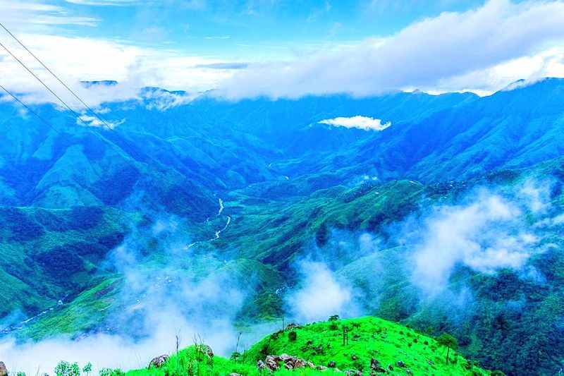
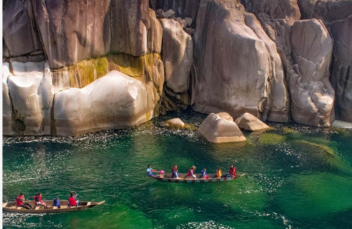
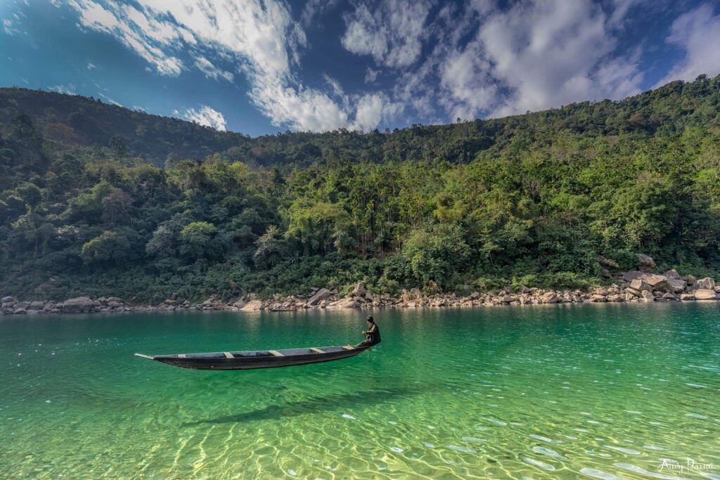
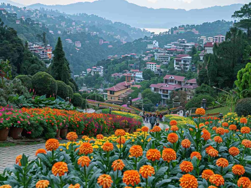
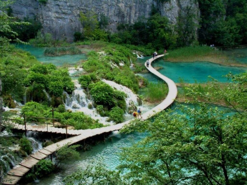
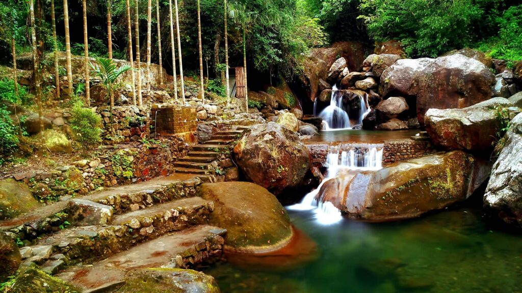
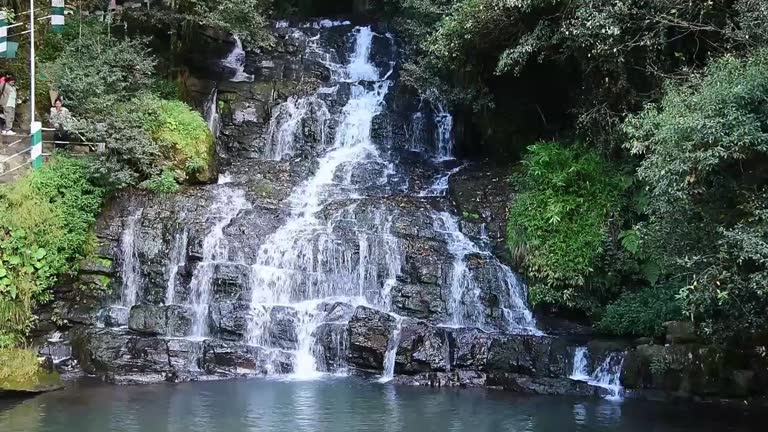
Meghalaya is a prominent destination for ecotourism and adventure tourism in India. With its breathtaking landscapes, pristine forests, and unique cultural heritage, it offers a wide range of attractions. The state’s natural beauty includes thick forests, waterfalls, caves, lakes, and the famous living root bridges, which have become significant tourist draws.
Adventure and Ecotourism
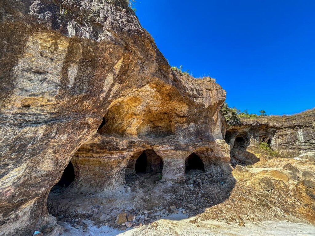
The state’s diverse topography, with hills, caves, and rivers, makes it ideal for adventure activities such as trekking, rock climbing, and spelunking. Meghalaya is home to some of the longest and deepest caves in India, with Krem Liat Prah being the longest. The state also offers various trekking routes, which provide opportunities to encounter rare flora and fauna.
One of the most famous adventure spots in Meghalaya is Cherrapunji, known for its stunning waterfalls, such as Nohkalikai Falls, one of the tallest plunge waterfalls in India. The state is also home to the living room bridges, an incredible feat of nature, where tree roots are intertwined over rivers to form bridges. These bridges, particularly in villages like Nongriat, attract tourists from around the world.
Major Attractions
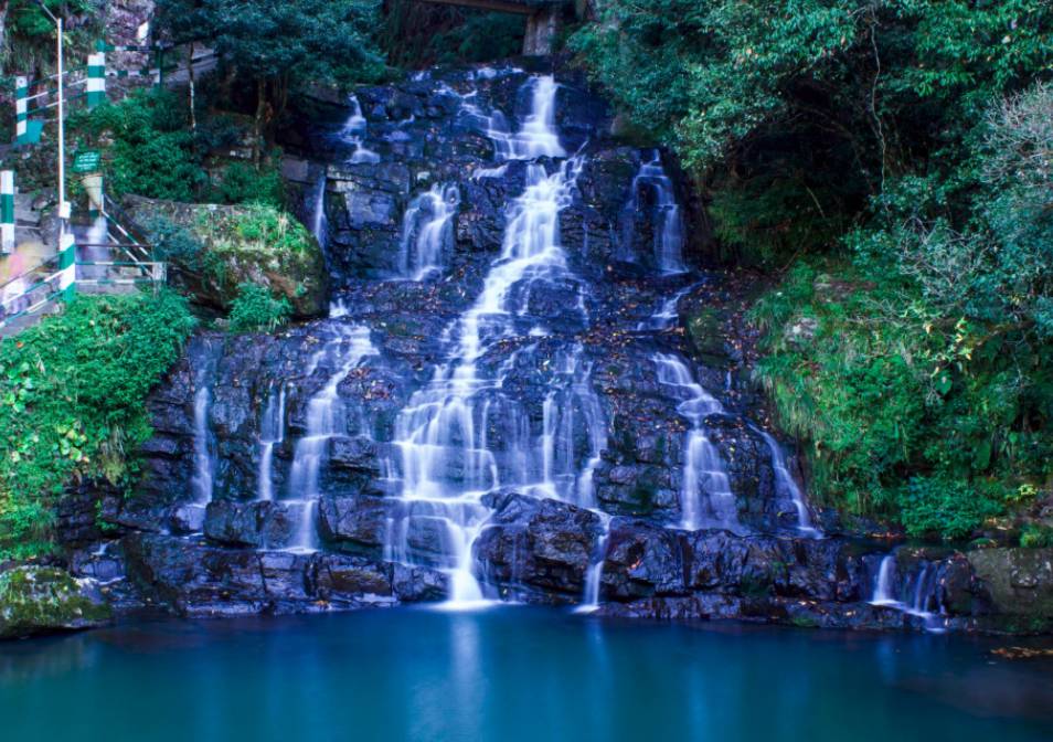
- Elephant Falls: Located near Shillong, this waterfall is known for its scenic beauty and is a popular tourist spot.
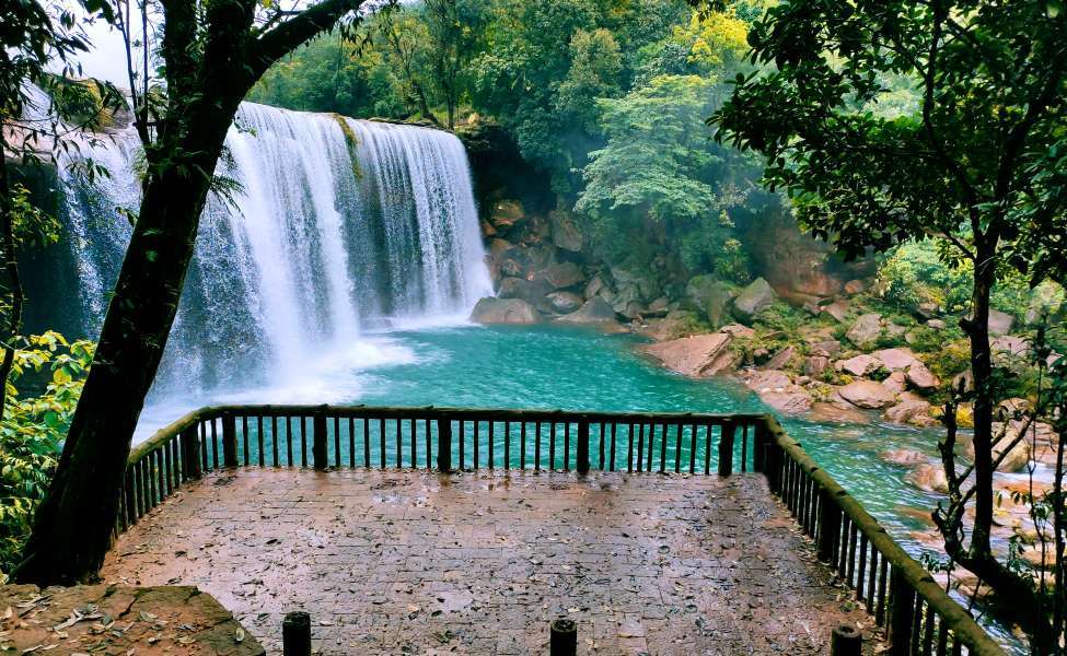
- Krang Suri Waterfall: Another mesmerizing waterfall known for its picturesque setting.
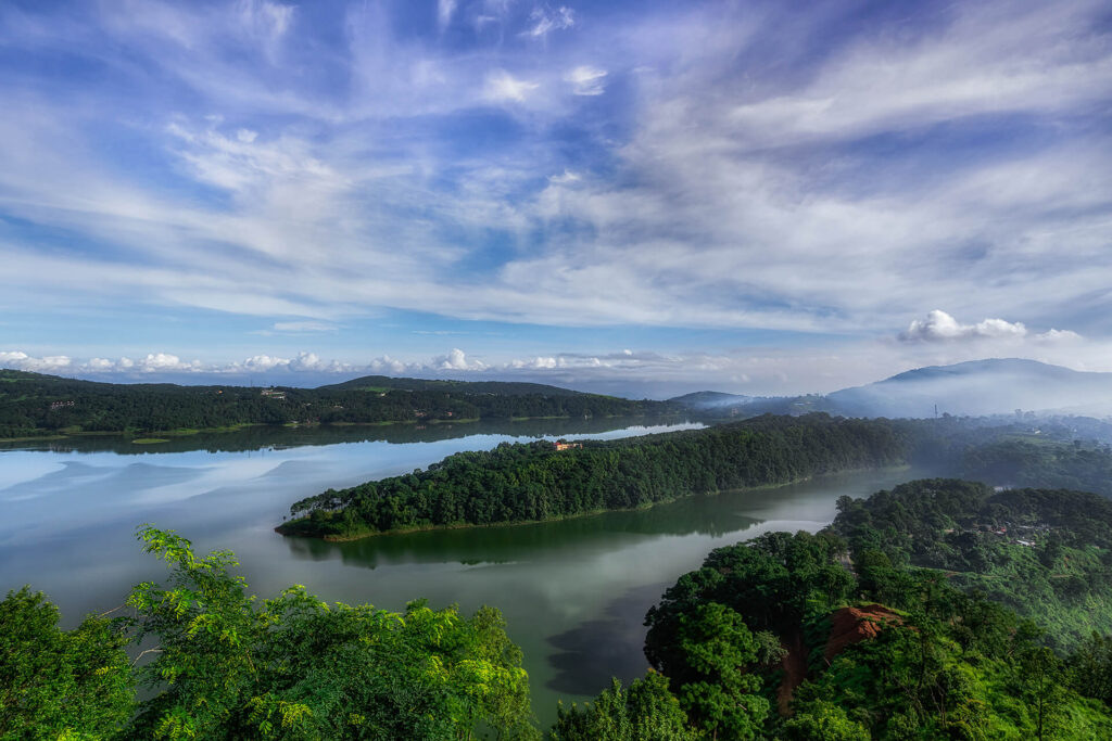
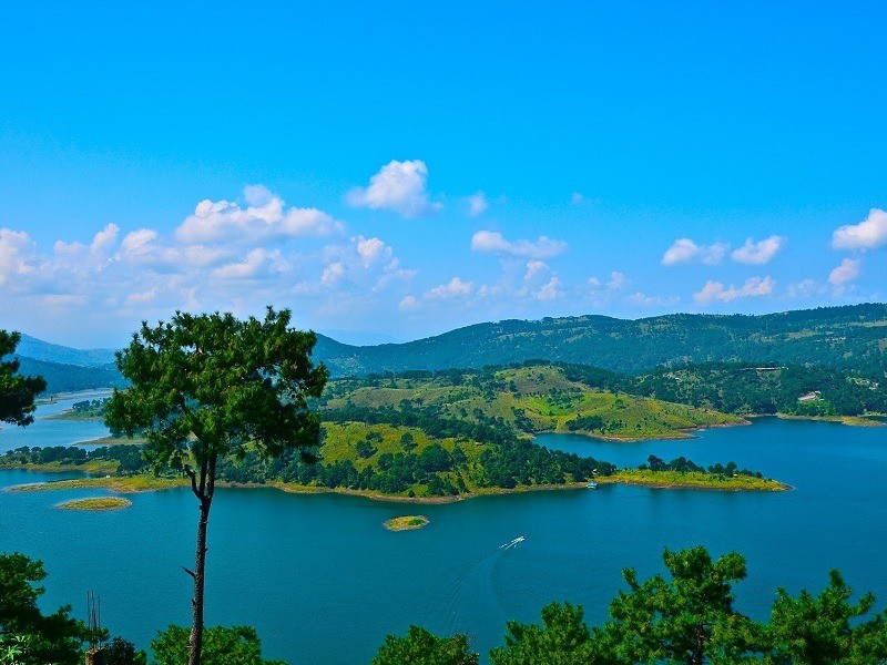
- Umiam Lake: This lake, also called Bara Pani, offers water sports and beautiful landscapes.
- Living Root Bridges: Found in Cherrapunji and nearby villages, these root bridges are unique to Meghalaya and a significant attraction for visitors.
- Sacred Groves: The Mawphlang Sacred Forest is one of the most famous sacred groves in the state, known for its rich biodiversity and religious significance.
Meghalaya also boasts a wide range of wildlife, as it is home to several national parks and wildlife sanctuaries, including the Balpakram National Park and Nokrek National Park, which are important conservation areas.
Lakes and Rivers
Lakes such as the Umiam Lake and Thadlaskein Lake are popular spots for tourists, offering activities like boating and sightseeing. The state also has numerous rivers, with Nongkhnum Island, the largest river island in Meghalaya, being a major attraction. The Phanliang River and the Namliang River form the island, and the area is known for its stunning natural beauty and waterfalls.
Political Issues and Development Challenges
Despite its natural beauty, Meghalaya faces several challenges, including political instability and environmental concerns. One significant issue is illegal immigration, primarily from Bangladesh, which has led to tension in border areas. The state’s border with Bangladesh is porous, making it difficult to control migration. There have been repeated calls for stronger measures to address this issue, with some groups advocating for the better management of the state’s resources and infrastructure to control the influx of migrants.
Another problem is the practice of Jhum farming (shift cultivation), which, while deeply rooted in the local culture, poses significant environmental challenges. This form of agriculture involves clearing forests to grow crops, leading to deforestation and a loss of biodiversity. The practice also results in low agricultural yields and hampers the state’s long-term sustainability efforts.
Conclusion
Meghalaya offers an extraordinary blend of natural beauty, adventure tourism, and cultural heritage, but it also faces significant infrastructural and political challenges. Efforts to improve the state’s road network, expand rail and air connectivity, and develop sustainable tourism are ongoing. However, the region’s environmental issues and political instability require careful management to ensure balanced development that preserves its unique ecosystems and cultural traditions.

