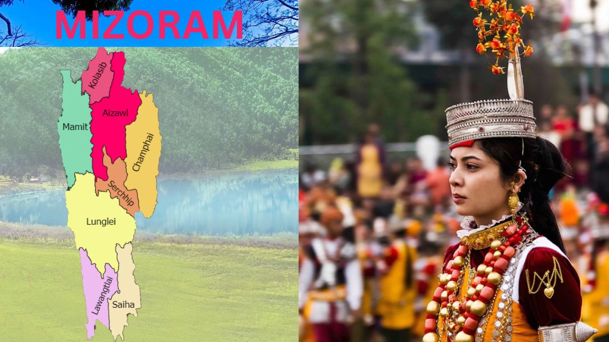
All About Mizoram
Mizoram, a landlocked state in northeastern India, is bordered by Bangladesh to the west, Myanmar to the east and south, and the Indian states of Assam, Manipur, and Tripura to the north. Covering an area of 21,087 square kilometers (8,139 sq mi), Mizoram is 91% forested, making it the most heavily forested state in India. With an estimated population of 1.25 million in 2023, it is the second least populated state in India.
Mizoram is the most urbanized state in northeast India, with an urbanization rate of 51.5%, ranking fifth nationwide. The state’s official language is Mizo, widely spoken as a lingua franca among various ethnic groups who also speak Tibeto-Burman or Indo-Aryan languages. Mizoram has the highest percentage of scheduled tribes in India, with the Mizo people forming the majority.
Early civilizations in Mizoram are believed to have thrived around 2,400 years ago, with evidence uncovered in the Vangchhia region. Over time, Tibeto-Burman-speaking peoples migrated from the Chin Hills in present-day Myanmar, forming chiefdoms and adopting jhum (slash-and-burn) agriculture. By the 18th century, various clans united to form the Mizo identity, introducing the Mizo language, culture, and the Sakhua religion. In the mid-19th century, the British annexed Mizoram in 1895, incorporating it into the Assam Province, where administrative reforms and the spread of Christianity significantly impacted society.
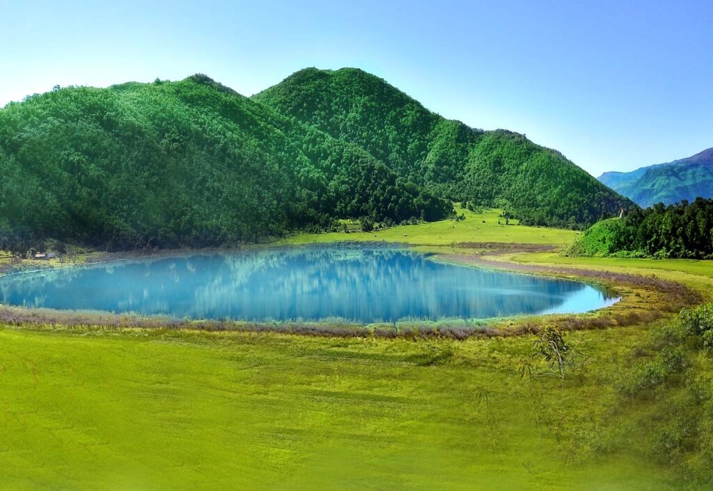
Mizoram: The Land of the Mizos – A Forested Paradise.
After India’s independence in 1947, Mizoram remained part of Assam as the Lushai Hills District. Following the Assamese Government’s negligence during a famine, an insurgency led by the Mizo National Front culminated in the Mizoram Peace Accord in 1986, granting the state full statehood on 20 February 1987.
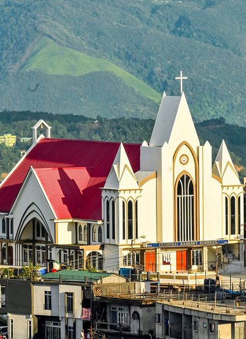
Mizoram has a Christian majority (about 87% of the population), predominantly of Protestant denominations such as Presbyterian and Baptist. Other religions, including Buddhism, Hinduism, and Islam, are also practiced. The population is mainly composed of the Mizo or Zo tribes (about 83.4%), with significant communities of Chakma (8.5%) and Tripuri (3%). The state has also seen an influx of Burmese refugees, particularly from the Chin ethnic group, due to the civil conflict in Myanmar, with an estimated 70,000 to 100,000 refugees residing in the state.
Mizoram has a high literacy rate and an agrarian economy, with slash-and-burn farming (jhum) traditionally practiced. However, in recent years, the state has seen a shift toward horticulture and the production of bamboo products. The state’s gross state domestic product for 2012 was estimated at ₹69.91 billion (US$840 million), though about 20% of the population lives below the poverty line, with 35% rural poverty as of 2014. Mizoram has around 871 kilometers of national highways, connecting it to Assam and Manipur, and serves as a growing trade transit point with Myanmar and Bangladesh.
The name Mizoram is derived from the Mizo words “Mizo” (the native people) and “ram” (land), meaning “land of the Mizos” or “Mizo land.”
History of Mizoram
The Origins of the Mizo People
The origins of the Mizo people, like many other tribes in northeastern India, remain shrouded in mystery. Historically, the inhabitants of the Mizo Hills were often referred to as Cucis or Kukis by neighboring ethnic groups and British writers. It is claimed that the Kukis were the earliest known settlers of the Mizo Hills. Most tribes classified as “Mizo” today likely migrated to their current territories from neighboring regions in several waves, beginning around 1500 CE.
Chieftainship and Tribal Autonomy
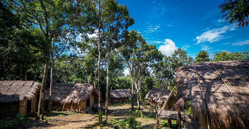
Before the advent of British rule, Mizo clans lived independently in villages led by tribal chiefs. These chiefs held significant authority and governed their respective territories, known as ram. Society was gerontocratic, and the primary livelihood was subsistence farming, notably jhum cultivation, a slash-and-burn agricultural method.
Although autonomous, the Mizo clans were nominally under the jurisdiction of rulers from Manipur, Tripura, and Burma. Tribal raids and headhunting were common practices, often involving ambushes, capturing slaves, and displaying the heads of defeated foes as symbols of victory.
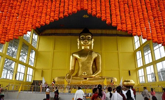
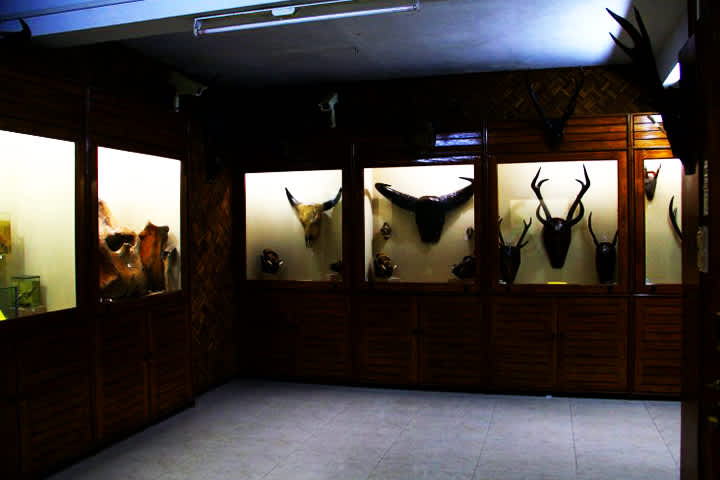
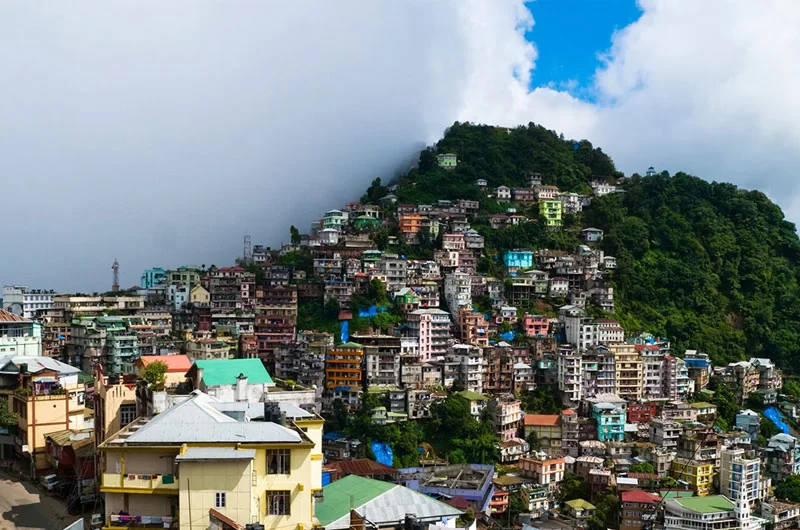
The British Era (1840s–1940s)
During the early 19th century, records of tribal raids and conflicts in the Mizo Hills attracted British attention. In the 1840s, Captain Blackwood led an expedition to punish a Palian chief for raiding British-controlled areas. Later, Captain Lester clashed with the Lusei tribe, sustaining injuries.
One notable incident occurred in 1849 when a Lusei raid resulted in the deaths of 29 members of the Thadou tribe and the capture of 42 individuals. In retaliation, Colonel Lister led the First British Invasion in 1850, burning a Lusei village of 800 houses and liberating 400 Thadou captives. Despite such actions, tribal raids persisted for decades, driven by the need for resources, slaves, and vengeance.
In 1889, the British formally annexed the Mizo Hills, integrating them into British India as part of Assam in the north and Bengal in the south. The region was designated as the Lushai Hills District, with Aizawl as its headquarters. Colonial rule brought an end to headhunting and other tribal practices deemed unacceptable by the British.
Post-Independence Era
Following India’s independence in 1947, the number of tribal chiefs in Mizoram had risen to over 200. This expansion faced opposition from the educated Mizo elite, who campaigned under the Mizo Union for the abolition of hereditary chieftainship. Their efforts led to the Assam-Lushai District (Acquisition of Chiefs’ Rights) Act of 1954, which abolished chieftainship. Village courts were reinstated as a means of local governance.
Christian missionaries, supported by the British, had earlier established a significant presence in Mizoram. Their efforts led to the widespread conversion of the Mizo population to Christianity, profoundly influencing the region’s cultural and religious identity.
Mizo National Front Uprising
Dissatisfaction with the government’s inadequate response to the 1959–60 mautam famine sparked unrest among the Mizo people. The Mizo National Famine Front, initially formed for famine relief, evolved into the Mizo National Front (MNF) in 1961. On 28 February 1966, the MNF launched an uprising in Aizawl, seeking independence from India.
The Indian government responded with coordinated airstrikes on 5–6 March 1966, marking the only instance of aerial bombings on Indian soil. The MNF then shifted to guerrilla tactics, using forested areas for operations. Villages were relocated closer to highways as part of the Indian Army’s counter-insurgency measures. The rebellion gradually subsided, culminating in the signing of the Mizo Accord in 1986.
Union Territory and Statehood
In 1971, Mizoram was granted Union Territory status, officially becoming a Union Territory in 1972. The signing of the Mizoram Peace Accord in 1986 brought peace to the region. Later that year, the Indian Parliament passed the 53rd Constitutional Amendment, paving the way for Mizoram’s statehood.
On 20 February 1987, Mizoram became India’s 23rd state. It was allocated two parliamentary seats, one in the Lok Sabha and another in the Rajya Sabha, cementing its integration into the Indian Union.
Geography of Mizoram
Mizoram, a landlocked state in northeastern India, shares an international border of 722 km with Myanmar and Bangladesh in its southern part. Domestically, it borders the states of Manipur, Assam, and Tripura. Covering an area of 21,087 km² (5th smallest in India), Mizoram stretches between 21°56’N to 24°31’N latitude and 92°16’E to 93°26’E longitude. The Tropic of Cancer passes nearly through the middle of the state. Its maximum north-south distance is 285 km, while its east-west stretch measures 115 km.
Topography
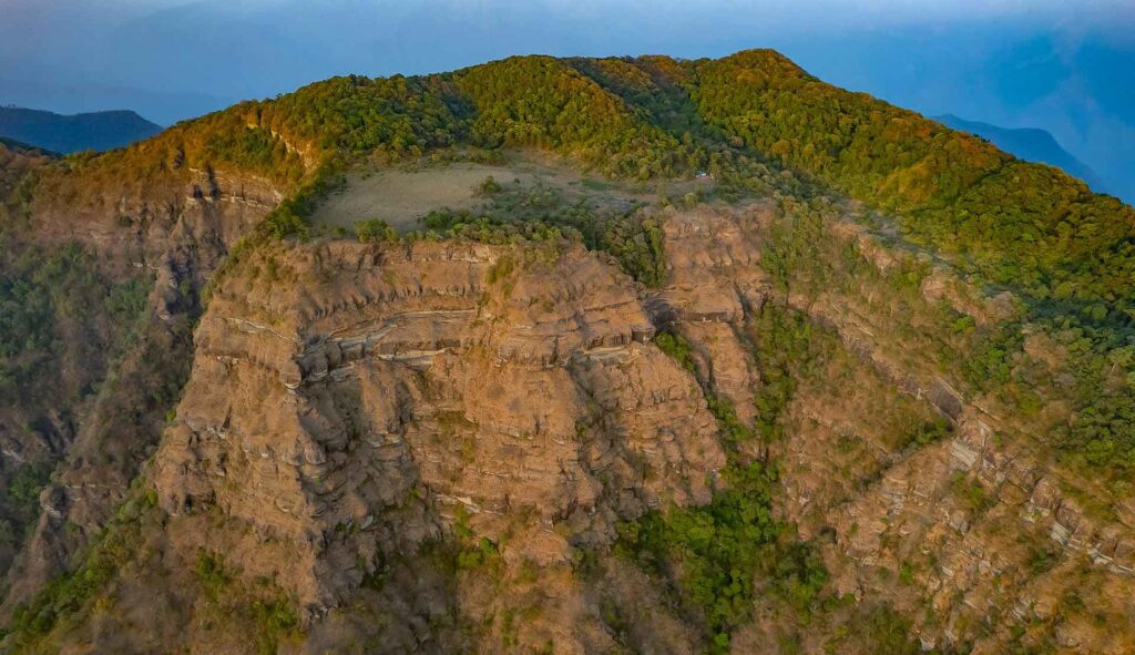
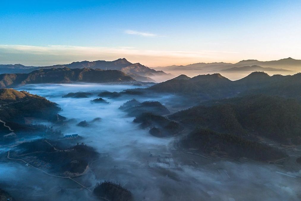
Mizoram is known for its rolling hills, valleys, rivers, and lakes. The state features 21 major hill ranges, with altitudes ranging from 1,000 m (3,300 ft) in the west to 1,300 m (4,300 ft) in the east. Some peaks exceed 2,000 m (6,600 ft), the highest being Phawngpui Tlang (Blue Mountain) at 2,210 m (7,250 ft).
- Forests cover 76% of the state, while 8% is fallow land and 3% barren. The remaining area is used for cultivation.
- The practice of slash-and-burn agriculture (jhum cultivation) continues, though discouraged due to its impact on the terrain.
- Mizoram has the highest forest cover percentage in India, with 84.53% of its area under forest, according to a 2021 Ministry of Environment report.
Rivers and Drainage
The Chhimtuipui River (Kaladan) is the largest river in Mizoram. Originating in Chin State, Myanmar, it traverses the Saiha and Lawngtlai districts, eventually returning to Myanmar.
Other major rivers include:
- Tlawng River
- Tut River
- Tuirial River
- Tuivawl River
These rivers are critical for the state’s agriculture and transportation. The rivers’ gentle drainage gradient, especially in the south, contrasts with the rugged hill ranges.
Geological Features
Mizoram’s terrain is classified by the Geological Survey of India as immature topography, consisting of:
- Longitudinal valleys with anticlinal hills and synclinal troughs.
- The western part comprises Neogene sedimentary rocks like sandstone, siltstone, and mudstone, while the Barail Group dominates the eastern terrain.
- Located in seismic zone V, Mizoram is highly prone to earthquakes, similar to other northeastern states.
Climate of Mizoram
Mizoram experiences a mild climate, with summer temperatures ranging from 20°C to 29°C (68°F to 84°F), and winter temperatures between 7°C and 22°C (45°F to 72°F). The state has a tropical moist to sub-tropical moist climate influenced by monsoons, with heavy rains from May to September.
- Annual rainfall averages 254 cm (100 in), with Aizawl receiving 215 cm (85 in) and Lunglei around 350 cm (140 in).
- Seasonal cyclones and landslides occasionally disrupt daily life.
Biodiversity in Mizoram
Mizoram ranks third in total forest cover and first in forest area percentage, with 90.68% of its geographical area under forests (2011 Forest Survey). The forests are categorized into:
- Tropical semi-evergreen
- Tropical moist deciduous
- Subtropical broadleaf hill forests
- Subtropical pine forests
Flora
- Bamboo is a significant component, covering 44% of the forest area.
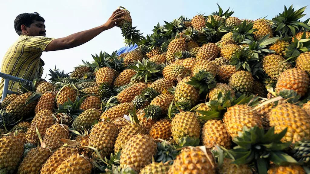
- Initiatives to reduce jhum cultivation have introduced horticulture crops like pineapple and banana.

Fauna
Mizoram is home to numerous bird and mammal species, many of which are endangered:
- State animal: Serow (Capricornis rubidus)
- State bird: Mrs. Hume’s Pheasant (Vavu)
- State tree: Indian rose chestnut (Herhse)
- State flower: Red Vanda (Senhri)
Prominent wildlife includes:
- Mammals: Tiger, leopard, clouded leopard, Asiatic black bear, and red serow.
- Primates: Hoolock gibbon, capped langur, and Phayre’s leaf monkey.
- Birds: Over 640 species, with 27 on threatened species lists.
Protected Areas
The state has:
- 2 National Parks: Phawngpui Blue Mountain National Park and Murlen National Park.
- 6 Wildlife Sanctuaries: Including the Dampa Tiger Reserve and Ngengpui Wildlife Sanctuary.
Historical Population Trends
The population of Mizoram has shown steady growth over the years. Here’s an outline of population growth based on census data:
| Year | Population | Growth Rate (%) |
|---|---|---|
| 1901 | 82,434 | — |
| 1911 | 91,204 | +10.6 |
| 1921 | 98,406 | +7.9 |
| 1931 | 124,404 | +26.4 |
| 1941 | 152,786 | +22.8 |
| 1951 | 196,202 | +28.4 |
| 1961 | 266,063 | +35.6 |
| 1971 | 332,390 | +24.9 |
| 1981 | 493,757 | +48.5 |
| 1991 | 689,573 | +39.7 |
| 2001 | 888,573 | +28.9 |
| 2011 | 1,091,014 | +22.8 |
Key Insights:
- Mizoram remains the second least populated state in India, with a density of 52 persons per square kilometer.
- The sex ratio is 976 females per 1,000 males, surpassing the national average of 940.
- Approximately 52% of the population resides in urban areas, significantly higher than India’s average.
Ethnic Composition
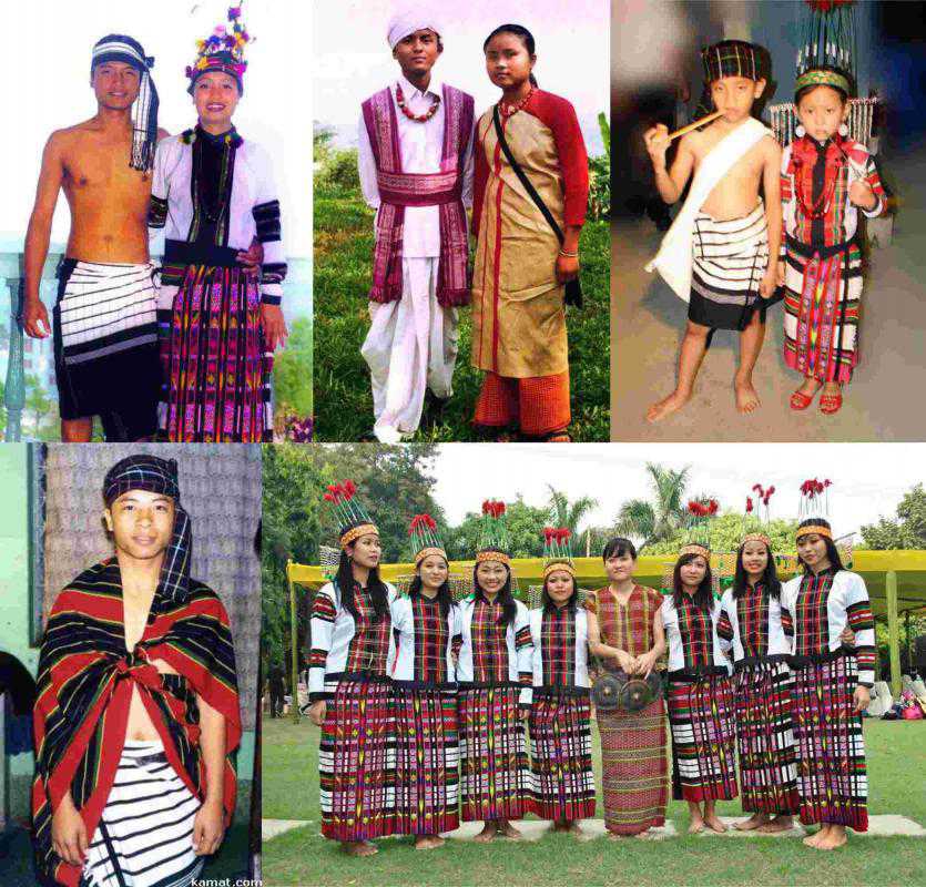
The majority of Mizoram’s population consists of various tribes collectively referred to as Mizos. The term “Mizo” is derived from “Mi” (people) and “Zo” (a progenitor’s name), meaning “People of Zo origin.”
Ethnic Tribes
- The Mizos migrated in waves across the Tiau River in the 16th century.
- Tribes are grouped into Old Kukis (e.g., Biate, Ranglong, Hrangkhol) and Lusei Kukis (e.g., Lushei, Paite, Lai, Mara, Hmar).
- Other ethnic groups include the Bru (Reang), Chakma, and Tanchangya, with some believed to have Indo-Aryan origins.
Non-Tribal Communities
- Significant populations of Nepalis and Bengalis settled during British rule.
- Mizoram also has descendants of Nepali Gorkhas encouraged to settle in Aizawl and other areas.
Scheduled Tribe Classification
- Nearly 95% of Mizoram’s population is classified under the Scheduled Tribe category, providing preferential treatment in education and employment.
Language Diversity
Languages spoken in Mizoram as per the 2011 census:
- Mizo (73.13%): The dominant language and an official language of the state.
- Other significant languages include:
- Chakma (8.51%)
- Mara (3.84%)
- Tripuri (2.99%)
- Pawi (2.62%)
- Minor languages: Paite, Hmar, and Bengali.
English is also an official language and widely used for administrative purposes.
Religion in Mizoram
Mizoram is predominantly Christian, but the state also exhibits religious diversity.
Religious Composition (2011 Census)
- Christianity (87.16%): Predominantly Presbyterian and Baptist denominations.
- Buddhism (8.51%): Followed mainly by the Chakma population.
- Hinduism (2.75%): Practiced by a small percentage, including some Bengalis and Nepalis.
- Islam (1.35%): A minority religion.
Christianity in Mizoram
- Introduced in 1894 by Welsh missionary David Evan Jones.
- By 1947, about 80% of the Lushei tribe had converted to Christianity.
- Presbyterian Church is dominant in the north, while the Baptist Church holds sway in the southern regions.
Buddhism
- Practiced by Chakmas and Tanchangyas, who have centuries-old Buddhist traditions.
Judaism
- Some Mizos claim descent from the Bnei Menashe, one of the lost tribes of Israel, practicing Judaism.
Revival of Tribal Religions
- Traditional Mizo religions like Hnam Sakhua emphasize cultural values and resist external influences like Christianity.
Largest Cities and Towns
Urbanization in Mizoram is centered around a few key cities:
| Rank | City/Town | District | Population |
|---|---|---|---|
| 1 | Aizawl | Aizawl | 415,000 |
| 2 | Lunglei | Lunglei | 80,000 |
| 3 | Champhai | Champhai | 44,000 |
| 4 | Saiha | Saiha | 35,500 |
| 5 | Kolasib | Kolasib | 34,200 |
Politics
Mizoram Assembly House
Originally, village land, locally called ram, was the property of the tribal chief. The institution of chieftainship began in the 16th century, where each village behaved like a small state, and the chief was called Lal. The rule was hereditary, and there were no written laws. The first script for the Mizo language was developed by Christian Missionaries Lorraine and Savidge around 1895.
After British annexation in the 1890s, the northern part of Mizoram was administered as the Lushai Hills district of Assam, while the southern part was part of Bengal. In 1898, the southern part was transferred from Bengal to Assam. The colonial powers retained the chiefs and Mizo customs, including the socially stratified hereditary transfer of political power. In 1937, under Section 6 of the Scheduled District Act, the British administration consolidated executive and legislative political power to the Deputy Commissioner and District Magistrates, with village chiefs playing an advisory role. The political and judiciary powers of chiefs were no longer final or exclusive, and rulings could be appealed to courts staffed with British officials.
After India gained independence from British rule, the region was granted autonomous status in 1952, allowing the Mizo people to formulate their own laws and deliver judicial decisions. The region was renamed as Mizo District within Assam State in April 1954, and in that year, the institution of hereditary chieftainship was abolished, with village courts/councils set up in its place.
The representatives of the Lushai Hills Autonomous District Council and the Mizo Union pleaded with the States Reorganisation Commission (SRC) to integrate the Mizo-dominated areas of Tripura and Manipur with the District Council in Assam. The tribal leaders in the northeast were unhappy with the final SRC recommendations and met in Aizawl in 1955 to form a new political party, the Eastern India Tribal Union (EITU).
In the 1950s, fears of Assamese hegemony and a perceived lack of government concern led to growing discontent among the Mizos. The Mizos were particularly dissatisfied with the government’s inadequate response to the 1959–60 mautam famine. The Mizo National Famine Front, formed for famine relief in 1959, later developed into a new political organization, the Mizo National Front (MNF) in 1961. The Front sought sovereign independence for the Mizo territory, staging an armed insurrection with the 28 February 1966 uprising against the government. The revolt was suppressed by the Indian government, which carried out airstrikes in Aizawl and surrounding areas.
Assam state was split and re-organised into multiple political regions. The Mizo hills area was declared Mizoram after the insurgency, and it received status as a Union Territory in 1972. A Peace Accord was signed between the central government and insurgent groups of Mizoram on 30 June 1986, which led to the surrender of insurgents’ arms, and Mizoram became the 23rd state of India in 1986, formalized the following year. The first election of Mizoram Legislative Assembly was held on 16 February 1987. Elections have been held at 5-year intervals since then, with 2018 elections for 40 seats of the legislative assembly seeing a voter turnout of 80%. The Mizo National Front, led by Zoramthanga, was elected to power.
Kambhampati Hari Babu has served as the Governor of Mizoram since November 2021.
Administration
The Mizoram State Legislative Assembly has 40 seats, and the Village Councils are the grassroots of democracy and leadership in Mizoram. The state has a Chief Minister and a Council of Ministers responsible for various portfolios.
There are 11 districts in Mizoram, with each district headed by a Deputy Commissioner responsible for the administration. The Deputy Commissioner is the executive head of the district, in charge of implementing government regulations, maintaining law and order, and overseeing tax collection. A Superintendent of Police oversees the police administration of each district.
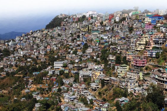
The capital city, Aizawl, is managed by the Aizawl Municipal Corporation, and the town of Lunglei is managed by the Lunglei Municipal Council.
The state has 3 autonomous district councils for ethnic minorities:
- Chakma Autonomous District Council
- Lai Autonomous District Council
- Mara Autonomous District Council
Economy
Aizawl – The capital city of Mizoram
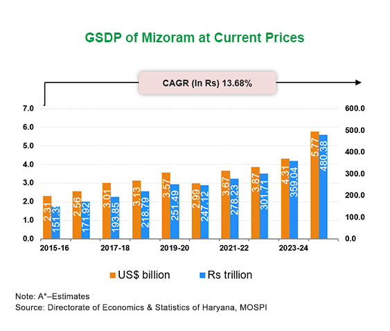
Mizoram’s gross state domestic product (GSDP) for 2011-2012 was around ₹69.91 billion (US$840 million). Over the period from 2001 to 2013, the state’s GSDP growth rate averaged nearly 10% annually. By 2019, the provisional GSDP was estimated at ₹251.4857 billion (US$3.0 billion). Situated with international borders with Bangladesh and Myanmar, Mizoram serves as an essential trade state for Southeast Asian imports to India, as well as for exports from Indiators to the state’s GSDP growth are agriculture, public administration, and construction work. The tertiary sector (services) continues to dominate, contributing between 58% and 60% of the GSDP over the past decade .
As of 2013, apof Mizoram’s population was below the poverty line, a rate similar to India’s national average of 21.9%. Rural poverty is notably higher, with 35.4% of rural residents living below the poverty line, compared to the national rural average of 25.7%. Urban poverty in Mizoram is lower, at 6.4%.
Mizoram has a **highly literate worith a literacy rate approaching 90%, and widespread use of English. The state’s infrastructure includes 4,300 kilometers of roads, with 927 kilometers of national highways and 700 kilometers of state highways. Mizoram is working on developing the Kolodyne River (Chhimtuipui lui) for navigation and international trade. The state also has an airport in its capital, Aizawl. Mizoram faces a power deficit, but it has plans to tap into its hydroelectric potential. The state’s economy also benefits from the handloom and horticulture industries, while tourism is a growing sector. In 2008, nearly 7,000 registered companies were operating in Mizoram. To boost economic growth, the state government is implementing Special Economic Zones (SEZs) .
Agriculture
A paddy field in Zawlen 55% and 60% of the working population in Mizoram is engaged in agriculture. The sector’s contribution to the GSDP was 30% in 1994 but had reduced to 14% by 2009 as other sectors grew.
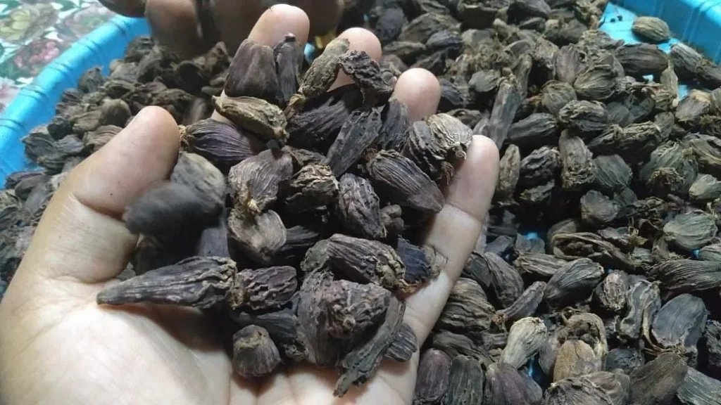
Agriculture in Mizoram has traditionally been subsistence farming as the largest crop. Fruits, condiments, and spices are also significant agricultural products.


Jhum Practice
Main article: Jhum
Before 1947, Mizoram practh-and-burn Jhum cultivation**, a form of shifting agriculture. The state government discouraged this practice, and it has gradually declined. A 2012 report estimated that 30% of the state’s agricultural area was used for Jhum cultivation, mostly for rice production . Despite labor-intensive cultivation, the yields are low: Mizoram’s average rice yiels about 70% of India’s average, and only 26% of the rice consumed annually in Mizoram is produced locally【24】.
Horticulture
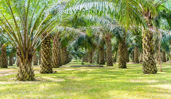
Oil palm in Mamit
Mizoram is a significant producer and exporter of Anthurium, with an annual output exceeding 7 million flowers, and roses. It also produces banana, ginger, turmeric, passion fruit, orange, and chowchow. Horticulture now contributes a growing part of the economy, with 6% of cultivated land devoted to horticultural products in 2009, increasing to 9.4% in 2013 .
The state faces challenges such as low agricultural productivity, despite receiving abundans soil** and lack of irrigation infrastructure impact crop yields, but this also presents an opportunity for organic farming.


Forestry, Fisheries, and Sericulture
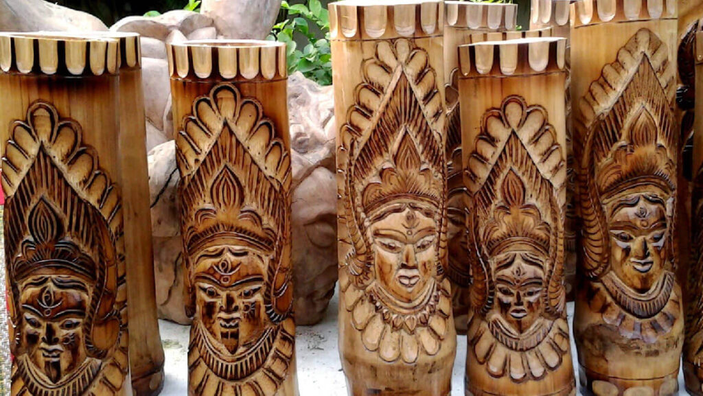
Mizoram is a leading producer of bamboo in India, contributing abou the nation’s commercial bamboo. Forest products contribute 5% to the state’s gross product. Mizoram also produces 5,200 metric tonnes of fish annually, only 12% of the potential sustainable output . Sericulture is a prominent industry in the state, providing employment for over 8,000 families across 300 Mizo villageuces over 7 million tonnes of Anthurium, supplying the domestic market and exporting to countries such as the UAE, UK, and Women in Mizoram predominantly engage in this business, contributing significantly to the state’s economy .
Industry
Mizoram has two industrial estates located at Zuangtui and Kolasib, with a software technology park under development at Mizore government has also acquired 127 acres of land in Khawnuam for the development of an Indo-Myanmar border trade township.
Energy Infrastructure
Mizoram is not self-sufficient in electricity. In 2012, the state’s power demand was 107 MW, but its installed capacity was only 29.35 MW.urchasing power from the national grid . The state has significant hydroelectric potential, estimated at 3600 MW in 2010, and could generate even more by developing its hydroelectric projects on rivers such as Tuivai, Tuivang, and others .
Proposed projects include a 460 MW project on the Kolodyne River, with many smaller projects also planned. If these projects are realized, Mizoram could achieve energy self-sufficiency and potentially e national grid .
The state’s energy infrastructure includes:
- Tuirial Dam (60 MW)
- Serlui B Dam (12 MW)
- Vankal Solar Park (20 MW) .
Mizoram’s transportation infrastructure plays a significant role in the state’s development and connectivity, although it faces challenges due to its topography and environmental conditions.

Road Network
In 2012, Mizoram had a total road network of approximately 8,500 km, including both surfaced national highways and unsurfaced rural roads. The state had about 871 km of national highways, 1,663 km of state highways, and 2,320 km of surfaced district roads. The roads connect 23 urban centres and 59% of its 764 villages. However, the state struggles with frequent landslides and weather-related damages, which often disrupt transport, especially in the monsoon season.
Air Transport
Mizoram’s air connectivity is mainly served by Lengpui Airport, located near the capital Aizawl. The airport has a runway length of 3,130 feet and serves regional flights. Additionally, a helicopter service operated by Pawan Hans connects Aizawl to several other towns such as Lunglei, Lawngtlai, Saiha, and Champhai, further enhancing the state’s transportation options.
Waterways and River Transport
Mizoram is in the process of developing waterway transport along its largest river, Chhimtuipui (also called Kolodyne River), which flows into Myanmar. This initiative, known as the Kaladan Multi-modal Transit Transport Project, aims to connect Mizoram to the Sittwe port in Myanmar. The project is part of India’s larger strategy to enhance trade routes and economic integration with Southeast Asia. The development involves dredging the Kaladan River and building roads linking Paletwa in Myanmar to Lomasu in Mizoram, which will ultimately improve trade and access to Myanmar and beyond.
Education System
Mizoram’s education system has evolved significantly over the years, with a high literacy rate of 92% as of the 2011 census, making it one of the most literate states in India. The state’s education system has grown rapidly, and the first school was established in 1898 by Christian missionaries.
As of 2012, there were 3,894 schools in Mizoram, including primary, middle, and secondary schools. Approximately 42% of schools are government-owned, while 28% are private without government subsidies. The teacher-pupil ratio is favorable, with a ratio of 1:20 for primary and 1:9 for middle school students.
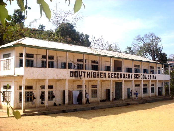

Higher education in Mizoram is provided by Mizoram University, which offers 29 undergraduate departments and has two affiliated professional institutions. Additionally, the state has other notable institutions, including the National Institute of Technology Mizoram and ICFAI University.
The education infrastructure is complemented by a strong focus on improving skills in fields like veterinary sciences, paramedical studies, and animal husbandry, making the state well-equipped for both academic and vocational training.
Overall, Mizoram’s transport and education infrastructure are vital to its socio-economic development, with improvements in roads, air transport, and waterways enhancing connectivity, and the growing educational sector providing the skilled workforce needed for future growth.
Culture of Mizoram
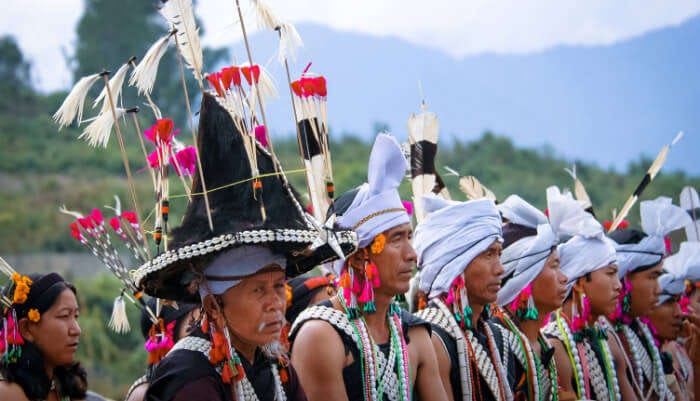
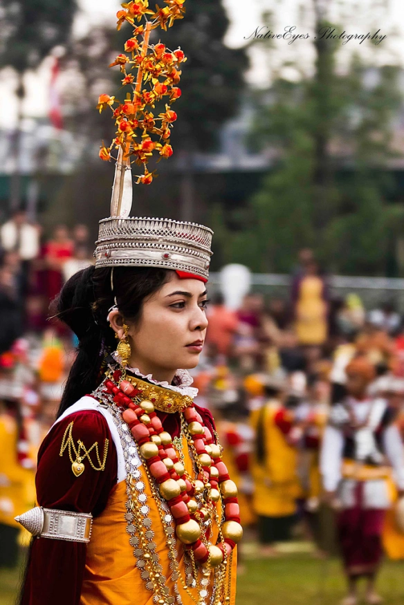
Mizoram’s culture is deeply rooted in its history, religious beliefs, and societal values, with significant influence from Christianity. The state’s cultural practices, customs, and social structures have evolved over time, blending traditional Mizo heritage with modern influences.



Tlawmngaihna: The Core Cultural Value
One of the key cultural concepts in Mizoram is Tlawmngaihna, which embodies values such as self-sacrifice, bravery, and perseverance. This concept does not have a direct English translation, but it can be described as a spirit of selflessness, determination, and a strong moral compass. It reflects the Mizo people’s commitment to maintaining their reputation and fulfilling their obligations to society without expecting personal gain or recognition.
Ancient Mizo Traditions
Several traditional customs and practices, which were prevalent before the advent of Christianity, are still remembered in Mizoram:
- Zawlbuk: This was a central feature of Mizo villages, acting as both a bachelor’s house for young men and a defense camp during times of conflict. It served as a community hub for the youth and was an essential part of village life.
- Pathian: The term for God in the Mizo language, to whom prayers and hymns were dedicated. The evil spirits, in contrast, were called ramhuai.
- Nula-rim: This was the traditional method of courtship and family structure in ancient Mizo society. Pre-marital relationships were accepted, and if a woman became pregnant, the man was required either to marry her or pay a fine. While premarital sex was accepted, women who were virgins at marriage were held in higher esteem.
- Ramri lehkha: Refers to the boundary marking the land owned by the chief, known as ram, which was inherited by the chief’s family and worked by the community.
Traditional Festivals
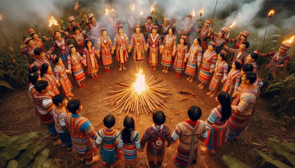
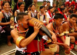
Mizoram celebrates a variety of traditional festivals, many of which are linked to the agricultural cycle and jhum (slash-and-burn) cultivation. These festivals are important community events that bring people together to celebrate and express gratitude for the harvest and the seasons.
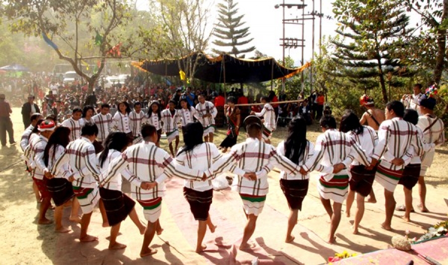
- Chapchar Kut: One of the most significant festivals, celebrated in February or March, marking the beginning of spring before the jhum process starts. It is a festival of dancing, feasting, and community spirit. Originally, it included home-brewed alcohol and meat delicacies, but in the present-day context, due to the state’s dry laws, it focuses on music, traditional dances, and community participation.
- Thalfavang Kut: This festival celebrates the completion of the weeding of jhum crops and is marked by celebrations and feasts.
- Mim Kut and Pawl Kut: Other important festivals celebrating the harvest and community.

Performing Arts
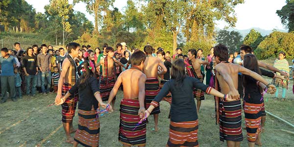
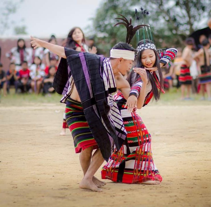
Mizoram is known for its vibrant traditional dances, which are performed during festivals and other community gatherings. These dances require great skill and coordination, often involving intricate movements and music.
- Cheraw: Known as the bamboo dance, this involves men holding bamboo sticks close to the floor while women in colorful dresses step in and out between them in rhythm with the music. It requires exceptional coordination and agility.
- Khual Lam: A mixed-gender dance traditionally performed after a successful hunt, celebrating the community’s success. It is characterized by swaying cloths and rhythmic movements.
- Chheih Lam: Performed during cool evenings, participants sit in a circle, and dancers in the center sing impromptu compositions about recent events or guests. This dance sometimes incorporates humor and often occurs in social settings.
- Chai Lam: An important dance performed during Chapchar Kut, where men and women form a circle, holding each other by the waist or shoulders and moving in rhythmic steps to the music. It symbolizes unity and celebration.
Sports in Mizoram
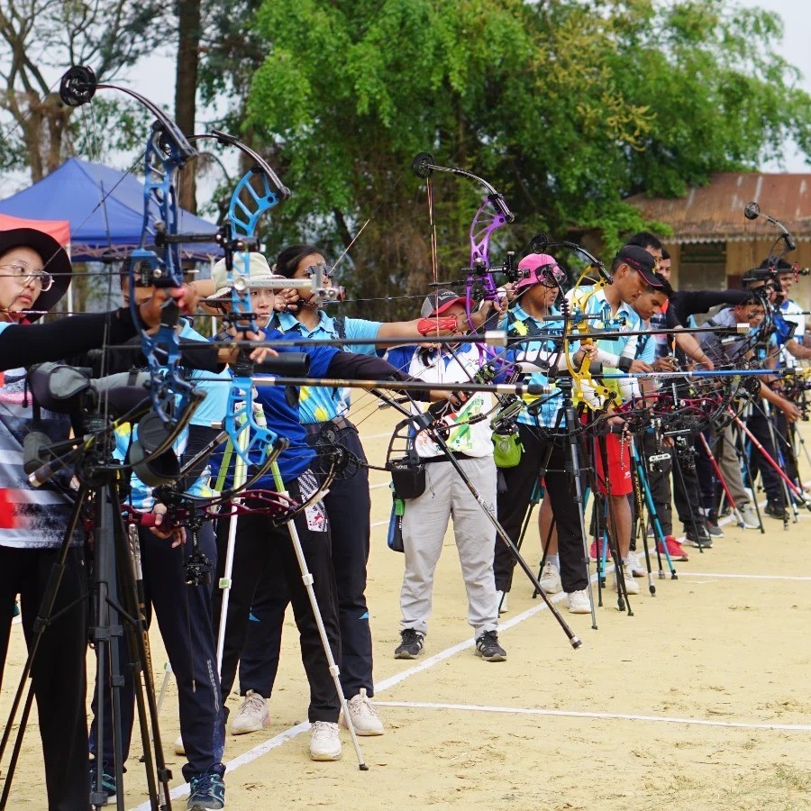
Mizoram has a growing sports culture, with football being the most popular sport. The Mizoram Premier League (MPL), which began in October 2012, is the state’s top football competition. The league features eight teams and is a major event in Mizoram’s sports calendar. Football has become an important part of the state’s identity, with teams like Aizawl FC garnering widespread support from the local population. Football matches, especially those of the MPL, bring communities together and are celebrated with great enthusiasm.
Mizoram’s cultural heritage, through its festivals, traditional dances, and sports, reflects the resilience and unity of its people. While modern influences such as Christianity have shaped certain aspects of life in Mizoram, the preservation and celebration of traditional practices and values remain strong in the state’s identity.

Tourism in Mizoram
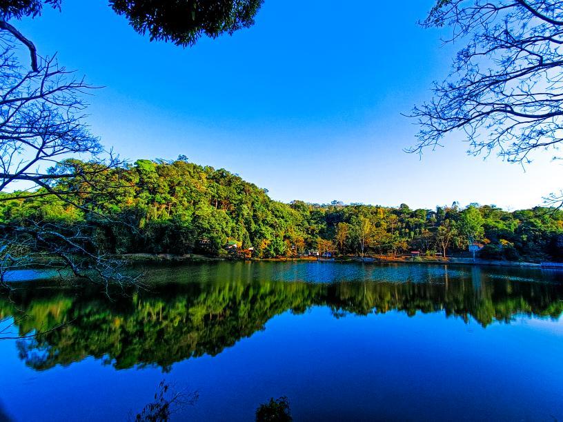
Mizoram, located in the northeastern part of India, is known for its lush landscapes, rich flora and fauna, and pleasant climate, making it a sought-after destination for nature lovers, adventure enthusiasts, and those interested in experiencing its unique culture.
Tourist Regulations
- Domestic Tourists: Indian citizens wishing to visit Mizoram are required to obtain an Inner Line Permit (ILP). This permit can be obtained from the Liaison officer of the government of Mizoram in various cities including Kolkata, Shillong, Guwahati, Silchar, and New Delhi. Visitors arriving by air can also get a 15-day visit pass at Lengpui Airport in Aizawl for a fee of ₹120 (approximately $1.40).
- International Tourists: Foreign nationals can obtain the necessary Protected Area Permit upon arrival. Like domestic tourists, international visitors must also register with the state police within 24 hours. However, nationals from Afghanistan, China, Pakistan, and those originating from these countries must acquire the permit through an Indian consulate or the Ministry of Home Affairs in New Delhi before arrival.
Major Attractions
Mizoram’s natural beauty is a key attraction for tourists, especially those interested in wildlife and bird watching. The state’s diverse landscapes provide a habitat for numerous species of flora and fauna, some of which are rare and endangered.
- Bird Watching: Mizoram is home to many species of birds, including the Mrs. Hume’s pheasant (Syrmaticus humiae), which is found in abundance in the region. The state’s forests are also known for sightings of wild water buffalo, Sumatran rhinoceros, and elephants.
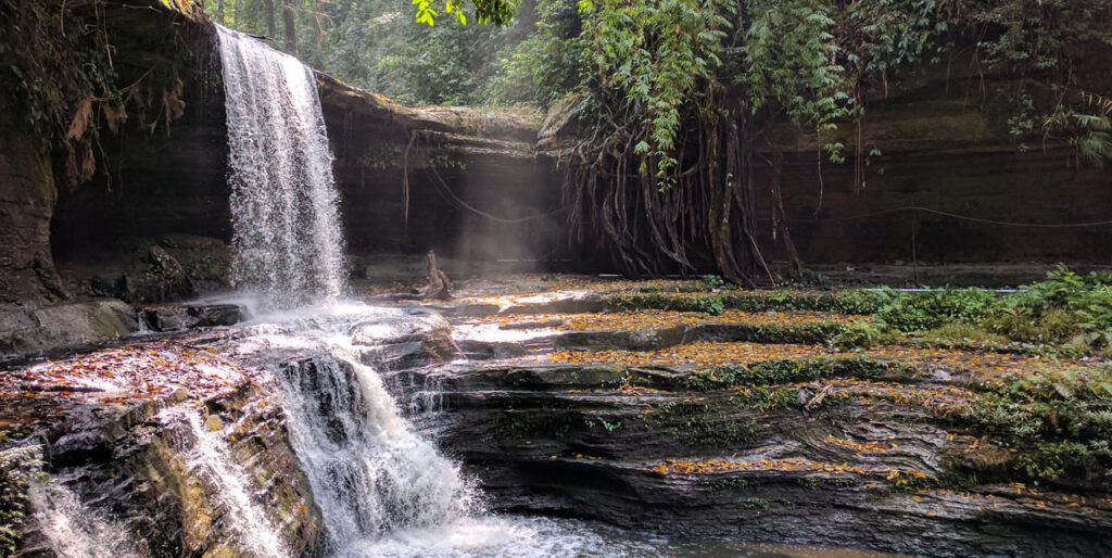
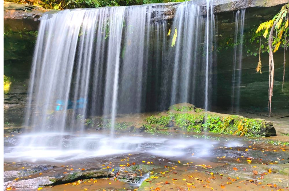
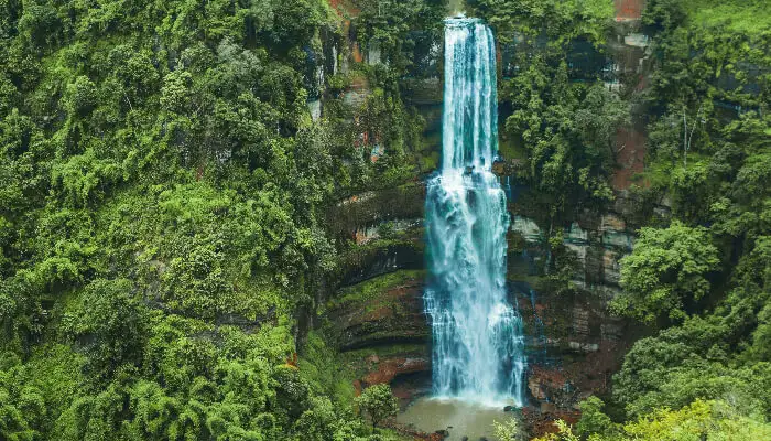
- Kawpi Waterfall: A popular destination for visitors, the Kawpi Waterfall offers stunning views and is a perfect spot for nature walks, photography, and relaxation.
Cultural Tourism
In addition to its natural beauty, Mizoram offers a unique cultural experience, with its traditional festivals, dance forms, and local handicrafts attracting tourists. The Chapchar Kut festival, celebrated in spring, is a vibrant display of traditional Mizo dance and music. Mizoram’s cultural richness provides a deep dive into the indigenous lifestyle and customs, especially for those keen on learning about the local tribes and traditions.
Challenges in Tourism
While Mizoram has great potential as a tourism destination, there are certain challenges that hinder the growth of the tourism sector:
- Chakma Land Issue: The Chakma people, a significant community in Mizoram, have been demanding the conversion of the Chakma Autonomous District Council into a Union Territory, which has sparked political debate and unrest. This ongoing issue is a concern for some potential tourists.
- Alcohol Prohibition: Mizoram has been a dry state since 1996, banning the sale of liquor. While the ban was initially introduced to curb alcohol consumption, the issue has sparked debate over the years. Some groups believe the law should remain in place, while others advocate for its repeal. The government has allowed the production and sale of certain wines made from fruits like grapes, apples, and guava. However, alcohol-related issues still exist, and the state has faced challenges in enforcing the prohibition effectively.
- Rat Problems (Mautam): Every 50 years, the bamboo species known as Mautam blooms, leading to an explosion in the rat population. These rats devastate crops, leading to food shortages. This phenomenon, referred to as the rat flood, has caused widespread agricultural damage in the past, with the most notable occurrence in 1958-59. Although the issue recurred in 2006-08, the damage to crops was short-lived, and yields recovered by 2009.
Media and Communication
Mizoram has seen significant progress in terms of media and communication, making it easier for tourists and locals alike to stay informed and connected.
- Television and Internet: Private television channels are popular in Mizoram, along with Doordarshan, the national broadcaster, which airs programs in the local Mizo language. Broadband access is available, and the internet is widely used for communication and entertainment.
- Print Media: Local newspapers like Vanglaini and Zalen provide valuable news and information about the region, while the Mizoram Post, an English-language daily, remains a popular choice for locals and tourists alike.
Mizoram’s growing media landscape helps in promoting the state’s tourism and culture, with digital platforms offering detailed information about attractions and activities.
Conclusion
Mizoram offers a unique blend of natural beauty, cultural richness, and historical significance. While there are challenges, such as political issues and a ban on alcohol, the state’s tourism sector is on the rise. With attractions like Kawpi Waterfall, birdwatching opportunities, and traditional festivals, Mizoram provides an unforgettable experience for those seeking an off-the-beaten-path destination.

